Back Circo glaciar AN دارة (جيولوجيا) Arabic Circu natural AST Kar (relyef forması) Azerbaijani Циркус Bulgarian Cirk BS Circ glacial Catalan Kar Czech Peiran Welsh Kar (Talform) German


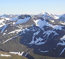
A cirque (French: [siʁk]; from the Latin word circus) is an amphitheatre-like valley formed by glacial erosion. Alternative names for this landform are corrie (from Scottish Gaelic: coire, meaning a pot or cauldron)[1] and cwm (Welsh for 'valley'; pronounced [kʊm]). A cirque may also be a similarly shaped landform arising from fluvial erosion.
The concave shape of a glacial cirque is open on the downhill side, while the cupped section is generally steep. Cliff-like slopes, down which ice and glaciated debris combine and converge, form the three or more higher sides. The floor of the cirque ends up bowl-shaped, as it is the complex convergence zone of combining ice flows from multiple directions and their accompanying rock burdens. Hence, it experiences somewhat greater erosion forces and is most often overdeepened below the level of the cirque's low-side outlet (stage) and its down-slope (backstage) valley. If the cirque is subject to seasonal melting, the floor of the cirque most often forms a tarn (small lake) behind a dam, which marks the downstream limit of the glacial overdeepening. The dam itself can be composed of moraine, glacial till, or a lip of the underlying bedrock.[2]
The fluvial cirque or makhtesh, found in karst landscapes, is formed by intermittent river flow cutting through layers of limestone and chalk leaving sheer cliffs. A common feature for all fluvial-erosion cirques is a terrain which includes erosion resistant upper structures overlying materials which are more easily eroded.
- ^ Chisholm, Hugh, ed. (1911). . Encyclopædia Britannica. Vol. 7 (11th ed.). Cambridge University Press. p. 196.
- ^ Cite error: The named reference
Knight2009was invoked but never defined (see the help page).