Back Canterbury (rehiyon) CEB Canterbury City German Ville de Canterbury French Kota Canterbury (New South Wales) ID Canterbury (Canterbury Bankstown) Italian シティ・オブ・カンタベリー (ニューサウスウェールズ州) Japanese City of Canterbury (Australië) Dutch City of Canterbury (Nowa Południowa Walia) Polish City of Canterbury, Australien Swedish 坎特伯雷市 (新南威爾斯州) Chinese
| City of Canterbury New South Wales | |||||||||||||||
|---|---|---|---|---|---|---|---|---|---|---|---|---|---|---|---|
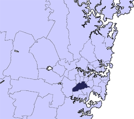
 Location in Metropolitan Sydney | |||||||||||||||
| Coordinates | 33°55′S 151°06′E / 33.917°S 151.100°E | ||||||||||||||
| Population | 146,314 (2012)[1] | ||||||||||||||
| • Density | 4,303.45/km2 (11,145.9/sq mi) | ||||||||||||||
| Established | 17 March 1879 (Municipality) 16 November 1993 (City) | ||||||||||||||
| Abolished | 12 May 2016 | ||||||||||||||
| Area | 34 km2 (13.1 sq mi) | ||||||||||||||
| Mayor | Brian Robson (Labor) | ||||||||||||||
| Council seat | Canterbury Administration Building, Campsie | ||||||||||||||
| Region | Inner West South West | ||||||||||||||
 | |||||||||||||||
| Website | City of Canterbury | ||||||||||||||
| |||||||||||||||
The City of Canterbury was a local government area in the Inner South-West[2] region of Sydney, New South Wales, Australia. The council area was within the northern part of the Parish of St George above Wolli Creek and The M5 but below The Cooks River. The city was primarily residential and light industrial in character, and was home to over 130 nationalities. With a majority of its residents being born overseas, the council marketed itself as the "City of Cultural Diversity." First incorporated as the Municipality of Canterbury in 1879, the council became known as the City of Canterbury in 1993.
The last Mayor of the City of Canterbury Council was Cr. Brian Robson, a member of the Labor Party, until 12 May 2016 when the City was amalgamated with the City of Bankstown, forming the City of Canterbury-Bankstown.
- ^ Australian Bureau of Statistics (31 October 2012). "Canterbury (C)". 2011 Census QuickStats. Retrieved 3 November 2012.
- ^ "2021 Sydney - Inner South West, Census All persons QuickStats | Australian Bureau of Statistics".