Back Coos Bay Afrikaans كوس باي Arabic کوس بای، اورقن AZB Кус Бей (град, Орегон) Bulgarian Coos Bay Catalan Куз-Бей (Орегон) CE Coos Bay (lungsod) CEB Coos Bay Czech Coos Bay, Oregon Welsh Coos Bay DAG
Coos Bay, Oregon | |
|---|---|
 The Tioga Building in July 2021 | |
| Nickname: Oregon's Bay Area | |
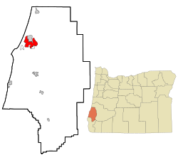
 Location in Oregon | |
| Coordinates: 43°22′35″N 124°14′14″W / 43.37639°N 124.23722°W | |
| Country | United States |
| State | Oregon |
| County | Coos |
| Named for | Coos Bay |
| Government | |
| • Mayor | Joe Benetti[1] |
| Area | |
| • City | 15.90 sq mi (41.19 km2) |
| • Land | 10.63 sq mi (27.53 km2) |
| • Water | 5.28 sq mi (13.66 km2) |
| • Urban | 27.71 sq mi (71.8 km2) |
| • Metro | 1,806.22 sq mi (4,678.1 km2) |
| Elevation | 138 ft (42 m) |
| Population | |
| • City | 15,985 |
| • Density | 1,503.90/sq mi (580.67/km2) |
| • Urban | 31,995 |
| • Metro | 64,620 |
| Time zone | UTC−8 (Pacific) |
| • Summer (DST) | UTC−7 (Pacific) |
| ZIP code | 97420 |
| Area code(s) | 458 and 541 |
| FIPS code | 41-15250[5] |
| GNIS feature ID | 2410223[3] |
| Website | www.coosbayor.gov |

Coos Bay is a city located in Coos County, Oregon, United States, where the Coos River enters Coos Bay on the Pacific Ocean. The city borders the city of North Bend, and together they are often referred to as one entity called either Coos Bay-North Bend or Oregon's Bay Area.[6] Coos Bay's population as of the 2020 census was 15,985 residents, making it the most populous city on the Oregon Coast. Oregon's Bay Area is estimated to be home to 32,308 (Coos Bay Census County Division).[7]
- ^ "Joe Benetti". www.coosbayor.gov.
- ^ "ArcGIS REST Services Directory". United States Census Bureau. Retrieved October 12, 2022.
- ^ a b U.S. Geological Survey Geographic Names Information System: Coos Bay, Oregon
- ^ Cite error: The named reference
USCensusDecennial2020CenPopScriptOnlywas invoked but never defined (see the help page). - ^ "U.S. Census website". United States Census Bureau. Retrieved December 21, 2012.
- ^ "Home". coosbaynorthbendcharlestonchamber.com.
- ^ "Explore Census Data".