| Part of a series on |
| Regions of Arkansas |
|---|
 |
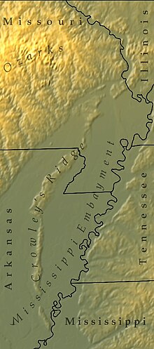
Crowley's Ridge (also Crowleys Ridge) is a geological formation that rises 250 to 550 feet (170 m) above the alluvial plain of the Mississippi embayment in a 150-mile (240 km) line from southeastern Missouri to the Mississippi River near Helena, Arkansas. It is the most prominent feature in the Mississippi Alluvial Plain between Cape Girardeau, Missouri, and the Gulf of Mexico.
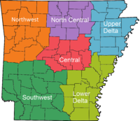
This narrow rolling hill region rising above the flat plain is the sixth, and smallest, natural division of the state of Arkansas. The southern part is protected within Ozark–St. Francis National Forest.
Most of the major cities of the Arkansas Delta region lie along Crowley's Ridge. It was named after Benjamin Crowley, known as the first American settler to reach the area, sometime around 1820. The Civil War Battle of Chalk Bluff was fought on Crowley's Ridge on May 1–2, 1863.
