Back مقاطعة دي باكا (نيومكسيكو) Arabic DeBaca County, New Mexico BAR Де Бака Bulgarian ডি বাকা কাউন্টি, নিউ মেক্সিকো BPY De Baca Gông (New Mexico) CDO Де-Бака (гуо, Нью-Мексико) CE De Baca County CEB De Baca County, Mecsico Newydd Welsh De Baca County German Condado de De Baca Spanish
De Baca County | |
|---|---|
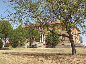
 De Baca County Courthouse in Fort Sumner | |
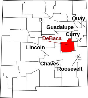
 Location within the U.S. state of New Mexico | |
 New Mexico's location within the U.S. | |
| Coordinates: 34°28′18″N 104°14′44″W / 34.47167°N 104.24556°W | |
| Country | |
| State | |
| Founded | February 28, 1917 |
| Named for | Ezequiel Cabeza De Baca |
| Seat | Fort Sumner |
| Largest village | Fort Sumner |
| Area | |
| • Total | 2,334 sq mi (6,050 km2) |
| • Land | 2,323 sq mi (6,020 km2) |
| • Water | 11 sq mi (30 km2) 0.5% |
| Population (2020) | |
| • Total | 1,698 |
| • Density | 0.73/sq mi (0.28/km2) |
| Time zone | UTC−7 (Mountain) |
| • Summer (DST) | UTC−6 (MDT) |
| Congressional district | 2nd |
| Website | debaca |
De Baca County is a county in the U.S. state of New Mexico. As of the 2020 census, the population was 1,698,[1] making it New Mexico's second-least populous county. Its county seat is Fort Sumner.[2] The county is named for Ezequiel Cabeza De Baca, the second elected Governor of New Mexico.[3]
- ^ "De Baca County, New Mexico". United States Census Bureau. Retrieved July 3, 2023.
- ^ "Find a County". National Association of Counties. Archived from the original on May 31, 2011. Retrieved June 7, 2011.
- ^ "De Baca County Extension Office". New Mexico State University. Archived from the original on July 14, 2012. Retrieved July 14, 2012.