Back مقاطعة دوستشتيس (أوريغون) Arabic Deschutes County, Oregon BAR Дъшутс (окръг, Орегон) Bulgarian দেসচুটেস কাউন্টি, অরেগন BPY Deschutes Gông (Oregon) CDO Deschutes County CEB Deschutes County Czech Deschutes County, Oregon Welsh Deschutes County German Condado de Deschutes Spanish
Deschutes County | |
|---|---|
 | |
 Location within the U.S. state of Oregon | |
 Oregon's location within the U.S. | |
| Coordinates: 43°55′N 121°13′W / 43.91°N 121.22°W | |
| Country | |
| State | |
| Founded | December 13, 1916 |
| Named for | Deschutes River |
| Seat | Bend |
| Largest city | Bend |
| Area | |
| • Total | 3,055 sq mi (7,910 km2) |
| • Land | 3,018 sq mi (7,820 km2) |
| • Water | 37 sq mi (100 km2) 1.2% |
| Population (2020) | |
| • Total | 198,253 |
| • Estimate (2023) | 208,513 |
| • Density | 65/sq mi (25/km2) |
| Time zone | UTC−8 (Pacific) |
| • Summer (DST) | UTC−7 (PDT) |
| Congressional districts | 2nd, 5th |
| Website | www |
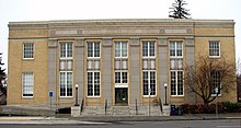
Deschutes County (/dəˈʃuːts/ də-SHOOTS) is one of the 36 counties in the U.S. state of Oregon. As of the 2020 census, the population was 198,253.[1] The county seat is Bend.[2] The county was created in 1916 out of part of Crook County and was named for the Deschutes River, which itself was named by French-Canadian trappers of the early 19th century. It is the political and economic hub of Central Oregon. Deschutes comprises the Bend, Oregon Metropolitan Statistical Area[3] and media market. Deschutes is Oregon's fastest-growing and most recently formed county.[4]
- ^ "State & County QuickFacts". United States Census Bureau. Retrieved April 9, 2022.
- ^ "Find a County". National Association of Counties. Archived from the original on May 31, 2011. Retrieved June 7, 2011.
- ^ "OMB Bulletin No. 20-01: Revised Delineations of Metropolitan Statistical Areas, Micropolitan Statistical Areas, and Combined Statistical Areas, and Guidance on Uses of the Delineations of These Areas" (PDF). United States Office of Management and Budget. March 6, 2020. Archived (PDF) from the original on October 9, 2022. Retrieved April 25, 2020.
- ^ Bilby, Robert; Hanna, Susan; Huntly, Nancy; et al. (July 8, 2007). "Human Population Impacts on Columbia River Basin Fish and Wildlife" (PDF). Independent Scientific Advisory Board. Archived from the original (PDF) on January 17, 2013. Retrieved September 15, 2008.