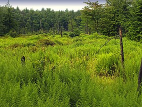
| Devil's Elbow Natural Area | |
|---|---|
 | |
| Location | Lycoming County, Pennsylvania |
| Nearest town | Grover |
| Coordinates | 41°34′17″N 76°49′13″W / 41.5714°N 76.8203°W |
| Area | 404 acres (163 ha) |
Devil's Elbow Natural Area is a 404-acre (163 ha) protected area in Lycoming County, Pennsylvania, United States. It is part of Loyalsock State Forest.[1][2]
- ^ "Loyalsock State Forest Wild and Natural Areas". Pennsylvania Department of Conservation & Natural Resources. Retrieved 2024-06-30.
- ^ Fergus, Charles (2002). Natural Pennsylvania: Exploring the State Forest Natural Areas. Mechanicsburg, PA: Stackpole Books. pp. 149–151.

