Back جبال ديوا ARZ Dewa Sanchi CEB 出羽山地 Japanese Ciadëina de Dewa LLD Дева (горы) Russian เทือกเขาเดวะ Thai
| Dewa Mountains | |
|---|---|
| 出羽山地 (Japanese) | |
 | |
| Highest point | |
| Peak | Mount Chōkai |
| Elevation | 2,236 m (7,336 ft)[1] |
| Coordinates | 39°30′0″N 140°9′36″E / 39.50000°N 140.16000°E |
| Geography | |
 | |
| Country | Japan |
| Prefectures | Aomori Akita Yamagata |
| Parent range | Japanese Alps |
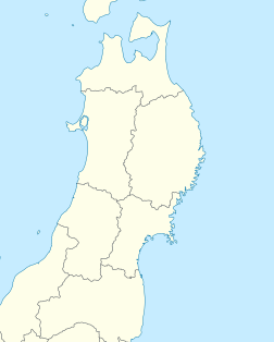
Dewa Mountains (Japanese: 出羽山地) is a mountain range that runs north and south on the west side of the Tohoku region of Japan.[2] The mountain range spans Aomori, Akita, and Yamagata prefectures.[2][3][4] The Dewa Mountains are split into several sub-ranges by the Yoneshiro River, the Omono River and the Mogami River.[5] These sub-ranges include the Shirakami Mountains, the Tahei Mountains, The Choki Mountains, and the Chotake Mountains.[6][5]The highest peak of the mountain range is Mount Chokai (2,236m).[7]
- ^ "Japan Ultra-Prominences". Peaklist.org. Retrieved 2015-01-01.
- ^ a b 第2版, ブリタニカ国際大百科事典 小項目事典,デジタル大辞泉,日本大百科全書(ニッポニカ),百科事典マイペディア,精選版 日本国語大辞典,世界大百科事典. "出羽山地とは". コトバンク (in Japanese). Retrieved 2021-05-25.
{{cite web}}: CS1 maint: multiple names: authors list (link) CS1 maint: numeric names: authors list (link) - ^ "でわさんち【出羽山地】 | て | 辞典". 学研キッズネット (in Japanese). Retrieved 2021-05-25.
- ^ "【出羽山地】とは・意味 | エキサイト辞書". エキサイト辞書 (in Japanese). Archived from the original on 2021-05-25. Retrieved 2021-05-25.
- ^ a b 日本の自然2 東北 (Japanese Nature 2: Tohoku) ISBN 4-00-007932-8
- ^ "秋田県の地形・地盤 : ジオテック株式会社". www.jiban.co.jp. Retrieved 2024-09-14.
- ^ 第2版,世界大百科事典内言及, 日本大百科全書(ニッポニカ),事典・日本の観光資源,国指定史跡ガイド,ブリタニカ国際大百科事典 小項目事典,百科事典マイペディア,デジタル大辞泉,精選版 日本国語大辞典,事典 日本の地域遺産,世界大百科事典. "鳥海山とは". コトバンク (in Japanese). Retrieved 2021-05-25.
{{cite web}}: CS1 maint: multiple names: authors list (link) CS1 maint: numeric names: authors list (link)

