Back دونا Arabic دونا ARZ دونا AZB Дона Bashkir Дона Bulgarian Дона CE Dohna (munisipyo) CEB Donín (město) Czech Dohna German Dohna Esperanto
Dohna | |
|---|---|
_2006-10-19.jpg) Dohna | |
 Coat of arms | |
Location of Dohna within Sächsische Schweiz-Osterzgebirge district 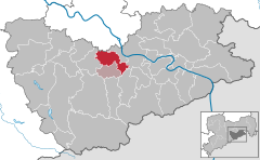 | |
 Dohna  Dohna | |
| Coordinates: 50°57′17″N 13°51′27″E / 50.95472°N 13.85750°E | |
| Country | Germany |
| State | Saxony |
| District | Sächsische Schweiz-Osterzgebirge |
| Municipal assoc. | Dohna-Müglitztal |
| Subdivisions | 12 |
| Government | |
| • Mayor (2022–29) | Ralf Müller[1] (CDU) |
| Area | |
| • Total | 28.57 km2 (11.03 sq mi) |
| Highest elevation | 150 m (490 ft) |
| Lowest elevation | 130 m (430 ft) |
| Population (2022-12-31)[2] | |
| • Total | 6,249 |
| • Density | 220/km2 (570/sq mi) |
| Time zone | UTC+01:00 (CET) |
| • Summer (DST) | UTC+02:00 (CEST) |
| Postal codes | 01809 |
| Dialling codes | 03529 |
| Vehicle registration | PIR |
| Website | www.stadt-dohna.de |
Dohna is a town in the Sächsische Schweiz-Osterzgebirge district, Saxony, Germany. It is located south of Heidenau, in the Müglitz valley and lies at the northeastern foot of the Eastern Ore Mountains. It is accessed by the Pirna interchange of highway A17, and by the Dohna (Sachs) and Köttewitz stations of the Müglitz Valley Railway.
- ^ Gewählte Bürgermeisterinnen und Bürgermeister im Freistaat Sachsen, Stand: 17. Juli 2022, Statistisches Landesamt des Freistaates Sachsen.
- ^ "Einwohnerzahlen nach Gemeinden als Excel-Arbeitsmappe" (XLS) (in German). Statistisches Landesamt des Freistaates Sachsen. 2024.