This article needs additional citations for verification. (June 2017) |
Domboshaba | |
 Domboshaba heritage site | |
 | |
| 20°40′S 27°25′E / 20.667°S 27.417°E | |
| Location | Masunga Village |
|---|---|
| Type | Monument |
| Opening date | (1250–1450 AD) |
| Dedicated to | History of Bakalaka |
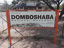
Domboshaba [pronunciation?] ruins is a cultural and heritage site in Botswana originally occupied towards the end of the Great Zimbabwe period (1250–1450 AD). The site is a respected place for the people living in the region and it is believed that the chief lived on the top of the hill together with his helpers or assistants.[1][2]
The phrase Dombo means hill and the word Shaba means red (translated from the Ikalanga language means "red" or eland Hill).[3] Domboshaba is also called the Luswingo used to be the settlement of the Great chief of that time. The ruins are similar to the Mwenemotapa. The chief's wife settled below the hill. Domboshaba has other ranges of hills along it, a natural water well located in Mantenge hill, called Mantenge Well which never dries up: the well is 7 metres deep and is situated in the rock.[4][5]
- ^ "Domboshaba ruins". Republic of Botswana, Government portal. Retrieved 14 June 2017.
- ^ Walker, Nick (2010). "Recent Research at Domboshaba Ruin, North East District, Botswana". Botswana Notes and Records. 42: 147–153. ISSN 0525-5090. JSTOR 23237979.
- ^ Brook, Michael C. (2017). Botswana Monuments, Heritage sites and Museums. Gaborone, Botswana: Kwena Pools. p. 100. ISBN 9789996805660.
- ^ "Conservation and Development of Mantenge Conservation Area (Botswana) - Sécheresse info". www.secheresse.info. Retrieved 24 May 2022.
- ^ "Exploring Tourism Botswana". Archived from the original on 3 December 2019.
