Back E.C. Manning Park CEB Manning Provincial Park German Parc provincial E. C. Manning French Parco provinciale E. C. Manning Italian E.C. Manning Park Swedish
| E. C. Manning Provincial Park | |
|---|---|
 Hiking the sub-alpine meadows in Manning Park. | |
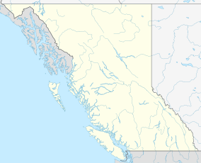
Location of Manning Park in British Columbia | |
| Location | British Columbia, Canada |
| Nearest town | Hope, British Columbia and Princeton, British Columbia |
| Coordinates | 49°4′0″N 120°47′0″W / 49.06667°N 120.78333°W |
| Area | 83,671 ha (206,760 acres) |
| Established | 1941 |
| Visitors | 1.091 million (in 2017-18)[2] |
| Governing body | BC Parks |
| Website | bcparks |
E.C. Manning Provincial Park is a provincial park in British Columbia, Canada. It is usually referred to as Manning Park, although that nomenclature is also used to refer to the resort and ski area at the park's core. The park covers 83,671 hectares (323 mi2) and was the second most visited provincial park in 2017-18 after Cypress Provincial Park.[2] The park lies along British Columbia Highway 3, and occupies a large amount of land between Hope and Princeton along the Canada-United States border.
- ^ "Protected Planet | E.C. Manning Park". Protected Planet. Retrieved 2020-10-16.
- ^ a b "BC Parks 2017/18 Statistics Report" (PDF). bcparks.ca. 2018. Archived from the original (PDF) on 2020-10-14. Retrieved 2020-10-13.
