| East Branch Penobscot River | |
|---|---|
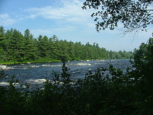
 East Branch Penobscot River, northeast of Millinocket, Maine. | |
| Location | |
| Country | United States |
| Physical characteristics | |
| Source | |
| • location | Maine |
| • elevation | 1,000 feet (300 m) |
| Mouth | |
• location | Penobscot River |
• coordinates | 45°36′32″N 68°32′02″W / 45.60889°N 68.53389°W |
• elevation | 240 feet (70 m) |
| Length | 75 miles (121 km) |
| Basin features | |
| Tributaries | |
| • left | Seboeis River |
The East Branch Penobscot River is a 75.3-mile-long (121.2 km)[1] tributary of Maine's Penobscot River. It flows in Piscataquis County and Penobscot County.
- ^ U.S. Geological Survey. National Hydrography Dataset high-resolution flowline data. The National Map Archived 2012-03-29 at the Wayback Machine, accessed June 22, 2011

