Back El Salvador Internasionale Lughawe Afrikaans مطار إل سلفادور الدولي Arabic Aeropuerto Internacional El Salvador CEB Flughafen San Salvador German Aeropuerto Internacional de El Salvador Spanish فرودگاه بینالمللی السالوادور Persian Aéroport international du Salvador French Aeroporto do Salvador Galician El Salvador nemzetközi repülőtér Hungarian Bandar Udara Internasional Cuscatlán ID
This article needs additional citations for verification. (April 2024) |
El Salvador International Airport Aeropuerto Internacional de El Salvador | |||||||||||||||
|---|---|---|---|---|---|---|---|---|---|---|---|---|---|---|---|
 The airport terminal in 2019 | |||||||||||||||
| Summary | |||||||||||||||
| Airport type | Military/Public | ||||||||||||||
| Operator | Autonomous Port Executive Commission (CEPA) | ||||||||||||||
| Serves | San Salvador, El Salvador | ||||||||||||||
| Location | San Luis Talpa | ||||||||||||||
| Opened | 31 January 1980 | ||||||||||||||
| Hub for | |||||||||||||||
| Time zone | CST (UTC−06:00) | ||||||||||||||
| Elevation AMSL | 31 m / 102 ft | ||||||||||||||
| Coordinates | 13°26′27″N 89°03′20″W / 13.44083°N 89.05556°W | ||||||||||||||
| Website | Official website | ||||||||||||||
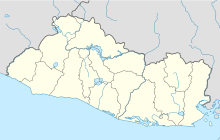
| Map | |||||||||||||||
| Runways | |||||||||||||||
| |||||||||||||||
| Statistics (2022) | |||||||||||||||
| |||||||||||||||
El Salvador International Airport Saint Óscar Arnulfo Romero y Galdámez (Spanish: Aeropuerto Internacional de El Salvador San Óscar Arnulfo Romero y Galdámez), (IATA: SAL, ICAO: MSLP), previously known as Comalapa International Airport (Aeropuerto Internacional de Comalapa) and as Comalapa Air Base (Base Aérea de Comalapa) to the military,[3] is a joint-use civilian and military airport that serves San Salvador, El Salvador. It is located in the south central area of the country, in the city of San Luis Talpa, Department of La Paz, and occupies a triangular plain of 2,519.8 acres (1,019.7 ha), which borders the Pacific Ocean to the south, is bordered to the east by the Jiboa River, and to the northwest by the coastal highway. Being close to sea level, it allows aircraft to operate efficiently at maximum capacity. It is connected to the capital of San Salvador, El Salvador, through a modern four-lane motorway, with 42 kilometres (26 mi) travel in an average time of 30 minutes.
It is the third of Central America in movement of passengers with 3,411,015 annually, counted without methodology, suggested by International Civil Aviation Organization (ICAO). It is classified as category 1 by the Federal Aviation Administration of the United States (FAA) and is certified by the Civil Aviation Authority (CAA), being the first in the isthmus to achieve these certifications.[5] In the Skytrax World Airport Awards 2015, it was recognized as the third best airport in Central America and the Caribbean.[6] According to the World Economic Forum, it is the second in the region with the most competitive infrastructure, achieving a score of 4.8 – 7.0 being the highest score – exceeded only by Panama (6.2).[7] In addition, ICAO recognizes it as one of the airports with the best security standards in the continent, only exceeded by airports in the United States and Canada.
- ^ "Portal de Transparencia - El Salvador".
- ^ "AIS – MSLP – EL SALVADOR". cocesna.org. Archived from the original on 27 July 2013. Retrieved 4 June 2015.
- ^ a b "Airport Information for MSLP". worldaerodata.com. World Aero Data. Archived from the original on 5 March 2019.
{{cite web}}: CS1 maint: unfit URL (link) Data current as of October 2006. - ^ "Comisión Ejecutiva Portuaria Autónoma – CEPA". Archived from the original on 18 June 2015. Retrieved 4 June 2015.
- ^ "Comalapa Airport receives International Security Certificate". La Prensa Gráfica (in Spanish). 18 December 2009. Archived from the original on 30 July 2012. Retrieved 12 July 2019.
- ^ "Top 10 Best Airports in Central America and Caribbean". Revista Estrategia & Negocios (in Spanish). Retrieved 12 July 2019.
- ^ "¿Quién tiene la peor y mejor infraestructura de transporte en Centroamérica?". Revista Summa (in European Spanish). 27 October 2015. Archived from the original on 12 July 2019. Retrieved 12 July 2019.
