Back Esplanaden metroasema (MRT) Finnish Stasiun MRT Esplanade ID Stesen MRT Esplanade Malay Esplanade Polish Esplanade MRT station SIMPLE எஸ்பிளனேட் தொடருந்து நிலையம் Tamil 滨海中心地铁站 WUU 滨海中心地铁站 Chinese 濱海中心站 ZH-YUE
CC3
Esplanade 滨海中心 எஸ்பிளனேட் | |||||||||||
|---|---|---|---|---|---|---|---|---|---|---|---|
| Mass Rapid Transit (MRT) station | |||||||||||
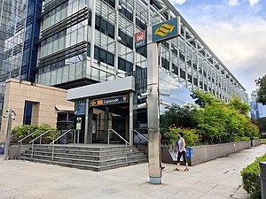
 Exit C of Esplanade station | |||||||||||
| General information | |||||||||||
| Location | 90 Bras Basah Road Singapore 189562[1] | ||||||||||
| Coordinates | 01°17′36″N 103°51′20″E / 1.29333°N 103.85556°E | ||||||||||
| Operated by | SMRT Trains Ltd (SMRT Corporation) | ||||||||||
| Line(s) | |||||||||||
| Platforms | 2 (1 island platform) | ||||||||||
| Tracks | 2 | ||||||||||
| Connections | NS25 EW13 City Hall Bus, Taxi | ||||||||||
| Construction | |||||||||||
| Structure type | Underground | ||||||||||
| Platform levels | 1 | ||||||||||
| Parking | Yes (Esplanade, Suntec City)[1] | ||||||||||
| Accessible | Yes[2] | ||||||||||
| History | |||||||||||
| Opened | 17 April 2010 | ||||||||||
| Electrified | Yes | ||||||||||
| Previous names | Convention Centre, War Memorial[3] | ||||||||||
| Services | |||||||||||
| |||||||||||
| |||||||||||
Esplanade MRT station is an underground Mass Rapid Transit (MRT) station on the Circle Line (CCL) in Singapore. Situated in the Downtown Core, it is at the junction of Bras Basah Road, Raffles Boulevard and Nicoll Highway. As the name suggests, the station serves the Esplanade performing arts centre, alongside various developments such as War Memorial Park, Suntec City Mall and the Suntec Singapore Convention and Exhibition Centre. Esplanade station is linked to the nearby City Hall station via CityLink Mall, an underground retail development.
First announced in 1999 as Convention Centre MRT station as part of the Marina MRT line, it was later incorporated into Stage 1 of the CCL. Several roads were diverted during its construction. The station was renamed Esplanade through a public poll in 2005. Along with the other stations on Stages 1 and 2 of the CCL, the station opened on 17 April 2010. Esplanade station features an Art-in-Transit artwork A Piece of Ice-Clear Heart by Lim Mu Hue.
- ^ a b "Esplanade MRT Station (CC3)". OneMap. Singapore Land Authority. Archived from the original on 5 May 2021. Retrieved 5 May 2021.
- ^ "An Inclusive Public Transport System". Land Transport Authority. 1 December 2020. Archived from the original on 18 January 2021. Retrieved 27 April 2021.
- ^ "Annex A: Finalised Names for Circle Line (CCL) Stages 1–3 Stations". Land Transport Authority. Archived from the original on 9 July 2011. Retrieved 9 July 2011.
