Back إستيس بارك (كولورادو) Arabic زتز پارک، کولورادو AZB Естъс Парк Bulgarian Estes Park Catalan Эстес-Парк (Колорадо) CE Estes Park (lungsod) CEB Estes Park, Colorado Welsh Estes Park German Estes Park (Colorado) Spanish Estes Park (Colorado) Basque
Estes Park, Colorado | |
|---|---|
| Town of Estes Park[1] | |
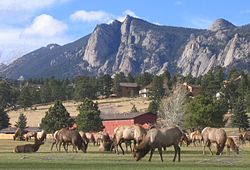
 Estes Park Golf Course | |
 Location of the Town of Estes Park in Larimer County, Colorado. | |
Location of the Town of Estes Park in the United States. | |
| Coordinates: 40°22′38″N 105°31′32″W / 40.377117°N 105.525514°W[2] | |
| Country | United States |
| State | Colorado |
| County | Larimer[1] |
| Settled | 1859 |
| Incorporated | April 17, 1917[3] |
| Government | |
| • Type | Statutory town[1] |
| • Mayor | Wendy Koenig-Schuett |
| Area | |
| • Total | 6.897 sq mi (17.862 km2) |
| • Land | 6.822 sq mi (17.668 km2) |
| • Water | 0.075 sq mi (0.194 km2) |
| Elevation | 7,522 ft (2,293 m) |
| Population | |
| • Total | 5,904 |
| • Density | 865/sq mi (334/km2) |
| • Metro | 359,066 (151st) |
| • Front Range | 5,055,344 |
| Time zone | UTC−07:00 (MST) |
| • Summer (DST) | UTC−06:00 (MDT) |
| ZIP Codes[5] | 80517 |
| Area code | 970 |
| FIPS code | 08-25115 |
| GNIS feature ID | 0204674 |
| Website | estespark |
Estes Park (/ˈɛstɪs/) is a statutory town in Larimer County, Colorado, United States.[1] The town population was 5,904 at the 2020 United States Census.[4] Estes Park is a part of the Fort Collins, CO Metropolitan Statistical Area and the Front Range Urban Corridor. A popular summer resort and the location of the headquarters for Rocky Mountain National Park, Estes Park lies along the Big Thompson River. Landmarks include The Stanley Hotel and The Baldpate Inn. The town overlooks Lake Estes and Olympus Dam.
- ^ a b c d e "Active Colorado Municipalities". Colorado Department of Local Affairs. Archived from the original on December 12, 2009. Retrieved October 18, 2021.
- ^ "2014 U.S. Gazetteer Files: Places". United States Census Bureau. July 1, 2014. Archived from the original on February 7, 2015. Retrieved January 6, 2015.
- ^ "Colorado Municipal Incorporations". State of Colorado, Department of Personnel & Administration, Colorado State Archives. December 1, 2004. Archived from the original on September 27, 2007. Retrieved September 2, 2007.
- ^ a b c "Decennial Census P.L. 94-171 Redistricting Data". United States Census Bureau, United States Department of Commerce. August 12, 2021. Archived from the original on December 17, 2021. Retrieved September 10, 2021.
- ^ "ZIP Code Lookup". United States Postal Service. Archived from the original (JavaScript/HTML) on March 5, 2012. Retrieved September 13, 2007.
