Back فانوود (نيوجيرسي) Arabic Fanwood AST فانوود، نیوجرسی AZB Fanwood Catalan Фенвуд (Нью-Джерси) CE Fanwood CEB Fanwood, New Jersey Welsh Fanwood German Fanwood Spanish Fanwood (New Jersey) Basque
Fanwood, New Jersey | |
|---|---|
 | |
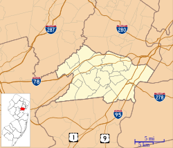
 Location of Fanwood in Union County highlighted in yellow (left). Inset map: Location of Union County in New Jersey highlighted in black (right). | |
 Census Bureau map of Fanwood, New Jersey | |
| Coordinates: 40°38′30″N 74°23′08″W / 40.641701°N 74.385692°W[1][2] | |
| Country | |
| State | |
| County | Union |
| Incorporated | October 2, 1895 |
| Named for | Fannie Wood |
| Government | |
| • Type | Borough |
| • Body | Borough Council |
| • Mayor | Colleen Mahr (D, term ends December 31, 2027)[3][4] |
| • Administrator | Rayna Harris[5] |
| • Municipal clerk | Kathleen Holmes[5] |
| Area | |
| • Total | 1.34 sq mi (3.47 km2) |
| • Land | 1.34 sq mi (3.47 km2) |
| • Water | 0.00 sq mi (0.00 km2) 0.00% |
| • Rank | 465th of 565 in state 18th of 21 in county[1] |
| Elevation | 157 ft (48 m) |
| Population | |
| • Total | 7,774 |
| • Estimate | 7,655 |
| • Rank | 301st of 565 in state 18th of 21 in county[12] |
| • Density | 5,801.5/sq mi (2,240.0/km2) |
| • Rank | 94th of 565 in state 10th of 21 in county[12] |
| Time zone | UTC−05:00 (Eastern (EST)) |
| • Summer (DST) | UTC−04:00 (Eastern (EDT)) |
| ZIP Code | |
| Area code(s) | 908 exchanges: 322, 490, 889[15] |
| FIPS code | 3403922860[1][16][17] |
| GNIS feature ID | 0885216[18] |
| Website | www |
Fanwood is a borough in Union County, in the U.S. state of New Jersey. Located on a ridge in northern-central New Jersey, the borough is a commuter town of New York City in the New York metropolitan area.[19] Fanwood is located in the Raritan Valley and Rahway Valley regions. As of the 2020 United States census, the borough's population was 7,774,[9][10] an increase of 456 (+6.2%) from the 2010 census count of 7,318,[20][21] which in turn reflected an increase of 144 (+2.0%) from the 7,174 counted in the 2000 census.[22]
Fanwood was incorporated as a borough by an act of the New Jersey Legislature on October 2, 1895, from portions of Fanwood Township (now known as Scotch Plains), based on the results of a referendum held the previous day.[23] The borough was named for Fannie Wood, an author.[24][25]
- ^ a b c 2019 Census Gazetteer Files: New Jersey Places, United States Census Bureau. Accessed July 1, 2020.
- ^ US Gazetteer files: 2010, 2000, and 1990, United States Census Bureau. Accessed September 4, 2014.
- ^ Cite error: The named reference
MayorCouncilwas invoked but never defined (see the help page). - ^ 2023 New Jersey Mayors Directory, New Jersey Department of Community Affairs, updated February 8, 2023. Accessed February 10, 2023.
- ^ a b Administration, Borough of Fanwood. Accessed March 28, 2023.
- ^ Cite error: The named reference
DataBookwas invoked but never defined (see the help page). - ^ "ArcGIS REST Services Directory". United States Census Bureau. Retrieved October 11, 2022.
- ^ U.S. Geological Survey Geographic Names Information System: Borough of Fanwood, Geographic Names Information System. Accessed March 5, 2013.
- ^ a b c Cite error: The named reference
Census2020was invoked but never defined (see the help page). - ^ a b Cite error: The named reference
LWD2020was invoked but never defined (see the help page). - ^ Cite error: The named reference
PopEstwas invoked but never defined (see the help page). - ^ a b Population Density by County and Municipality: New Jersey, 2020 and 2021, New Jersey Department of Labor and Workforce Development. Accessed March 1, 2023.
- ^ Look Up a ZIP Code for Fanwood, NJ, United States Postal Service. Accessed September 10, 2012.
- ^ Zip Codes, State of New Jersey. Accessed August 28, 2013.
- ^ Area Code Lookup - NPA NXX for Fanwood, NJ, Area-Codes.com. Accessed February 17, 2015.
- ^ U.S. Census website, United States Census Bureau. Accessed September 4, 2014.
- ^ Geographic Codes Lookup for New Jersey, Missouri Census Data Center. Accessed April 1, 2022.
- ^ US Board on Geographic Names, United States Geological Survey. Accessed September 4, 2014.
- ^ Capuzzo, Jill P., "Living in Fanwood, N.J.: A Future Coupled With Transit", The New York Times, Published May 6, 2014. Accessed July 26, 2023.
- ^ Cite error: The named reference
Census2010was invoked but never defined (see the help page). - ^ Cite error: The named reference
LWD2010was invoked but never defined (see the help page). - ^ Table 7. Population for the Counties and Municipalities in New Jersey: 1990, 2000 and 2010, New Jersey Department of Labor and Workforce Development, February 2011. Accessed May 1, 2023.
- ^ Snyder, John P. The Story of New Jersey's Civil Boundaries: 1606-1968, Bureau of Geology and Topography; Trenton, New Jersey; 1969. p. 238. Accessed September 12, 2012.
- ^ Hutchinson, Viola L. The Origin of New Jersey Place Names, New Jersey Public Library Commission, May 1945. Accessed August 30, 2015.
- ^ New Jersey, a Guide to Its Present and Past;, p. 548. Best Books, 1939. ISBN 9781623760298. Accessed August 30, 2015.


