Back محمية فورت بيك Arabic Reserva índia de Fort Peck Catalan Fort Peck Indian Reservation German Fort Peckin reservaatti Finnish Réserve indienne de Fort Peck French Fort Peck Yndianereservaat Frisian Форт-Пек Russian
This article needs additional citations for verification. (July 2012) |
Fort Peck Indian Reservation | |
|---|---|
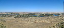
 Missouri River below Fort Peck Dam | |
 Location in Montana | |
| Coordinates: 48°21′40″N 105°32′18″W / 48.36111°N 105.53833°W | |
| Tribe | [Fort Peck Assiniboine and Sioux] |
| Country | United States |
| State | Montana |
| Counties | Daniels Roosevelt Sheridan Valley |
| Established | 1878 |
| Headquarters | Poplar |
| Government | |
| • Body | Fort Peck Tribal Executive Board |
| • Chairman | Justin GrayHawk Sr |
| • Vice-Chairman | Charles Headdress |
| Area | |
| • Total | 2,093,318 acres (847,136 ha) |
| Dimensions | |
| • Length | 110 mi (180 km) |
| • Width | 40 mi (60 km) |
| Population (2017)[2] | |
| • Total | 10,374 |
| • Density | 3.2/sq mi (1.3/km2) |
| Time zone | UTC-7 (MST) |
| • Summer (DST) | UTC-6 (MDT) |
| Area code | 406 |
| GDP | $385.9 Million (2018) |
| Website | fortpecktribes.org |

The Fort Peck Indian Reservation (Assiniboine: húdam wįcášta,[3] Dakota: Waxchį́ca oyáte[4]) is located near Fort Peck, Montana, in the northeast part of the state. It is the home of several federally recognized bands of Assiniboine, Lakota, and Dakota peoples of Native Americans.
With a total land area of 2,094,000 acres (8,470 km2; 3,272 sq mi),[5] it is the ninth-largest Indian reservation in the United States. These lands are spread across parts of four counties. In descending order of land area they are Roosevelt, Valley, Daniels, and Sheridan counties. Its resident population was 10,381 in 2000.[6] The largest community on the reservation is the city of Wolf Point.
- ^ "Fort Peck Tribes - Chairman". Retrieved July 24, 2019.
- ^ 2013-2017 American Community Survey 5-Year Estimates. "My Tribal Area". United States Census Bureau.
{{cite web}}: CS1 maint: numeric names: authors list (link) - ^ Indiana University of Bloomington, AISRI Dictionary Database Search, Assiniboine Dictionary, "húdam wįcášta" Link
- ^ Indiana University of Bloomington, AISRI Dictionary Database Search, Dakota Dictionary, "Waxchį́ca oyáte" Link
- ^ "Fort Peck Agency". Fort Peck Agency. Department of the Interior, Bureau if Indian Affairs. Retrieved February 17, 2016.
- ^ "Profile of General Demographic Characteristics: 2000 Geographic Area: Fort Peck Reservation and Off-Reservation Trust Land, MT" (PDF). United States Census Bureau. Archived from the original (PDF) on October 11, 2016. Retrieved February 17, 2016.