Back فورت بيير Arabic فورت بيير ARZ فرت پیر، گونئی داکوتا AZB Fort Pierre Catalan Форт-Пиер (Къилба Дакота) CE Fort Pierre CEB Fort Pierre, De Dakota Welsh Fort Pierre Danish Fort Pierre German Fort Pierre (Dakota del Sur) Spanish
Fort Pierre | |
|---|---|
 Main and Deadwood streets in Fort Pierre, South Dakota | |
| Motto: "Where The West Begins" | |
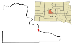
 Location in Stanley County and the state of South Dakota | |
| Coordinates: 44°22′04″N 100°22′59″W / 44.36778°N 100.38306°W | |
| Country | United States |
| State | South Dakota |
| County | Stanley |
| Founded | 1867 |
| Incorporated | June 2, 1890[1] |
| Government | |
| • Mayor | Gloria Hanson |
| Area | |
| • Total | 3.17 sq mi (8.20 km2) |
| • Land | 3.12 sq mi (8.08 km2) |
| • Water | 0.05 sq mi (0.12 km2) |
| Elevation | 1,440 ft (439 m) |
| Population | |
| • Total | 2,115 |
| • Estimate (2022)[5] | 2,142 |
| • Density | 678.10/sq mi (261.84/km2) |
| Time zone | UTC–7 (Mountain (MST)) |
| • Summer (DST) | UTC–6 (MDT) |
| ZIP code | 57532 |
| Area code | 605 |
| FIPS code | 46-22260 |
| GNIS feature ID | 1267393[3] |
| Website | fortpierre.com |
Fort Pierre is a city in Stanley County, South Dakota, United States. It is part of the Pierre, South Dakota micropolitan area and the county seat of Stanley County. The population was 2,115 at the 2020 census.[4]
The settlement of Fort Pierre developed around an 1832 trading post and fort situated on the west bank of the Missouri River, near the confluence with its tributary Bad River. An earlier American-owned trading post had been operating nearby since 1817, and in 2017 the city celebrated its bicentennial of continuous permanent settlement.
- ^ "SD Towns" (PDF). South Dakota State Historical Society. Archived from the original (PDF) on February 10, 2010. Retrieved February 11, 2010.
- ^ "2020 U.S. Gazetteer Files". United States Census Bureau. Retrieved July 24, 2022.
- ^ a b U.S. Geological Survey Geographic Names Information System: Fort Pierre, South Dakota
- ^ a b "Explore Census Data". United States Census Bureau. Retrieved January 8, 2024.
- ^ Cite error: The named reference
USCensusEst2022was invoked but never defined (see the help page).