Back Freiberg AN فرايبرغ Arabic فرايبرج ARZ Frayberq Azerbaijani فرایبرق AZB Фрайберг (Саксония) Bashkir Фрайберг Byelorussian Фрайберг Bulgarian Freiberg Catalan Фрайберг (Саксони) CE
Freiberg | |
|---|---|
 Freiberg with Peter's Church in December 2007 | |
 Coat of arms | |
Location of Freiberg within Mittelsachsen district 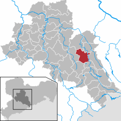 | |
 Freiberg  Freiberg | |
| Coordinates: 50°54′43″N 13°20′34″E / 50.91194°N 13.34278°E | |
| Country | Germany |
| State | Saxony |
| District | Mittelsachsen |
| Subdivisions | 8 |
| Government | |
| • Mayor (2022–29) | Sven Krüger[1] |
| Area | |
| • Total | 48.05 km2 (18.55 sq mi) |
| Elevation | 400 m (1,300 ft) |
| Population (2022-12-31)[2] | |
| • Total | 40,485 |
| • Density | 840/km2 (2,200/sq mi) |
| Time zone | UTC+01:00 (CET) |
| • Summer (DST) | UTC+02:00 (CEST) |
| Postal codes | 09599, 09596 |
| Dialling codes | 03731 |
| Vehicle registration | FG |
| Website | www.freiberg.de |
Freiberg is a university and former mining town in Saxony, Germany. It is a Große Kreisstadt (large county town) and the administrative centre of Mittelsachsen district.
Its historic town centre has been placed under heritage conservation and is a part of the UNESCO World Heritage Site known as the Ore Mountain Mining Region, due to its exceptional testimony to the development of mining techniques across many centuries.[3] Until 1969, the town was dominated for around 800 years by the mining and smelting industries. Since then it has restructured into a high technology site in the fields of semiconductor manufacture and solar technology, part of Silicon Saxony. It is home to the oldest extant university of mining and metallurgy in the world – the Freiberg University of Mining and Technology.
- ^ Gewählte Bürgermeisterinnen und Bürgermeister im Freistaat Sachsen, Stand: 17. Juli 2022, Statistisches Landesamt des Freistaates Sachsen.
- ^ "Einwohnerzahlen nach Gemeinden als Excel-Arbeitsmappe" (XLS) (in German). Statistisches Landesamt des Freistaates Sachsen. 2024.
- ^ "Erzgebirge/Krušnohoří Mining Region". UNESCO World Heritage Centre. United Nations Educational, Scientific, and Cultural Organization. Retrieved 9 June 2021.