Back فرويتفال (تكساس) Arabic فرويتفال ARZ فروتویل، تکزاس AZB Фрутвейл (Техас) CE Fruitvale (lungsod sa Tinipong Bansa, Texas) CEB Fruitvale, Texas Welsh Fruitvale (Texas) Spanish Fruitvale (Texas) Estonian Fruitvale (Texas) Basque فروتویل، تگزاس Persian
Fruitvale, Texas | |
|---|---|
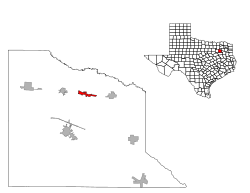
 Location of Fruitvale, Texas | |
| Coordinates: 32°40′59″N 95°47′59″W / 32.68306°N 95.79972°W | |
| Country | United States |
| State | Texas |
| County | Van Zandt |
| Government | |
| • Type | City Council |
| • Mayor | Jennifer Johnston |
| • U.S. House | Lance Gooden (R) |
| • State House | Bryan Slaton (R) |
| • State Senate | Bob Hall (R) |
| Area | |
| • Total | 1.91 sq mi (4.94 km2) |
| • Land | 1.89 sq mi (4.91 km2) |
| • Water | 0.01 sq mi (0.03 km2) |
| Elevation | 466 ft (142 m) |
| Population (2020) | |
| • Total | 476 |
| • Density | 250/sq mi (96/km2) |
| Racial Composition (2019)[2] | |
| • White | 80.7% |
| • Hispanic | 7.6% |
| • American Indian | 7.2% |
| • Black | 3.1% |
| • Other | 1.4% |
| Time zone | UTC-6 (Central (CST)) |
| • Summer (DST) | UTC-5 (CDT) |
| ZIP code | 75127 |
| Area code(s) | 430, 903 |
| GNIS feature ID | 1336284[3] |
Fruitvale is a small city in Van Zandt County, Texas, United States. The population was 408 at the 2010 census, and 476 as of 2020. The town draws its name from its location. Missouri Pacific Railroad in the center of the historic fruit-growing district of the Sabine River valley in northeastern Van Zandt County. Its name was originally Bolen Switch, but it was changed around 1901 after a petition of local fruit growers, and a post office was established in 1903. On April 29, 2017, an EF-3 tornado struck the town at EF-2 intensity, causing major damage and several injuries. Fruitvale Independent School District serves the town for head start to 12th grade.
- ^ "2019 U.S. Gazetteer Files". United States Census Bureau. Retrieved August 7, 2020.
- ^ "American Community Survey 5-Year Estimates 2015-2019". U.S. Census Bureau. Retrieved January 3, 2021.
- ^ "US Board on Geographic Names". United States Geological Survey. October 25, 2007. Retrieved January 31, 2008.