| Gaping Gill | |
|---|---|
 Entrance shaft viewed from the Main Chamber | |
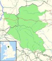
| Location | Ingleborough, North Yorkshire, England |
| OS grid | SD 75117270[1] |
| Coordinates | 54°08′58″N 2°22′57″W / 54.14956°N 2.382489°W |
| Depth | 192 metres (630 ft)[2] |
| Length | 21 kilometres (13 mi) (including Ingleborough Cave)[2] |
| Geology | Carboniferous limestone |
| Entrances | 21[1] |
| Access | Ingleborough Estate Office |
| BRAC grade | 4 |
Gaping Gill (also known as Gaping Ghyll) is a natural cave in North Yorkshire, England. It is one of the unmistakable landmarks on the southern slopes of Ingleborough – a 98-metre (322 ft) deep pothole with the stream Fell Beck flowing into it.[3] After falling through one of the largest known underground chambers in Britain, the water disappears into the bouldery floor and eventually resurges adjacent to Ingleborough Cave.[1][4]
The shaft was the deepest known in Britain, until Titan in Derbyshire was discovered in 1999.[5] Gaping Gill still retains the records for the highest unbroken waterfall in England and the largest underground chamber naturally open to the surface.
- ^ a b c Gardner, John. "Gaping Gill – A list of entrances". Retrieved 30 September 2012.
- ^ a b Dixon, Kevin (August–September 2016). "Gaping Gill: The Survey". Descent (251): 22–27.
- ^ Cordingley, John (2002). "The True Depth of Gaping Gill". Cave and Karst Science. 29 (3): 136.
- ^ "Gaping Gill". Bradford Pothole Club. Retrieved 14 November 2008.
- ^ "Battle of Titan's proportions after news of biggest cave". grough. 7 November 2006. Archived from the original on 25 April 2009. Retrieved 15 February 2014.

