| Gauley River | |
|---|---|
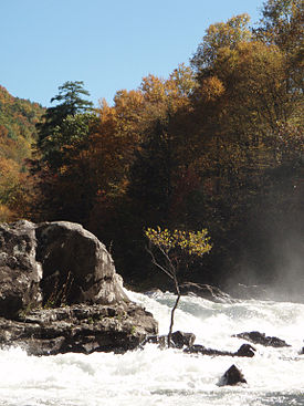
 Sweet's Falls on the Gauley River | |
 | |
| Location | |
| Country | United States |
| State | West Virginia |
| Counties | Randolph, Webster, Nicholas, Fayette |
| Physical characteristics | |
| Source | North Fork Gauley River |
| • location | Gauley Mountain, Pocahontas County, WV |
| • coordinates | 38°25′42″N 80°10′22″W / 38.42833°N 80.17278°W |
| • elevation | 4,000 ft (1,200 m) |
| 2nd source | South Fork Gauley River |
| • location | Pocahontas County, WV |
| • coordinates | 38°22′43″N 80°12′52″W / 38.37861°N 80.21444°W |
| • elevation | 3,937 ft (1,200 m) |
| 3rd source | Middle Fork Gauley River |
| • location | Pocahontas County, WV |
| • coordinates | 38°23′21″N 80°11′29″W / 38.38917°N 80.19139°W |
| • elevation | 3,844 ft (1,172 m) |
| Source confluence | Three Forks of Gauley |
| • location | Webster County, WV |
| • coordinates | 38°24′33″N 80°14′17″W / 38.40917°N 80.23806°W |
| • elevation | 2,917 ft (889 m) |
| Mouth | Kanawha River[2] |
• location | Gauley Bridge, WV |
• coordinates | 38°09′42″N 81°11′47″W / 38.16167°N 81.19639°W |
• elevation | 660 ft (200 m) |
| Discharge | |
| • location | Belva, WV[1] |
| • average | 2,680 cu ft/s (76 m3/s)[1] |
| • minimum | 341 cu ft/s (9.7 m3/s)(1976) |
| • maximum | 12,900 cu ft/s (370 m3/s)(1987) |
| Basin features | |
| Tributaries | |
| • left | Miller Mill Run, Williams River, Cranberry River, Meadow River |
The Gauley River is a 105-mile-long (169 km)[3] river in West Virginia. It merges with the New River to form the Kanawha River, a tributary of the Ohio River. The river features numerous recreational whitewater areas, including those in Gauley River National Recreation Area downstream of the Summersville Dam.
- ^ a b United States Geological Survey; USGS 03192000 GAULEY RIVER ABOVE BELVA, WV; retrieved April 19, 2008.
- ^ U.S. Geological Survey Geographic Names Information System: Gauley River
- ^ "The National Map". U.S. Geological Survey. Archived from the original on 2012-03-29. Retrieved Feb 17, 2011.
