Gemas
Gomeh | |
|---|---|
Town and mukim | |
| Other transcription(s) | |
| • Jawi | ڬمس |
| • Traditional Chinese | 金馬士 |
| • Simplified Chinese | 金马士 |
| • Tamil | கிமாஸ் |
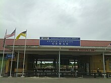
 Federal Route 1 passes through Gemas town centre, on the Negri side. | |
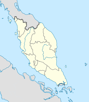
Location of Gemas in Peninsular Malaysia | |
| Coordinates: 2°35′N 102°35′E / 2.583°N 102.583°E | |
| Country | Malaysia |
| State | Negeri Sembilan |
| District | Tampin |
| Luak | Pasir Besar |
| Population (2010) | |
| • Total | 29,777 |
| • Demonym | Gemasian |
| Time zone | UTC+8 (MST) |
| • Summer (DST) | Not observed |
| National calling code | 07 |


Gemas (Negeri Sembilan Malay: Gomeh; Jawi: ڬمس) is a small town and a mukim in Tampin District, Negeri Sembilan, Malaysia,[1] near the Negeri Sembilan-Johor state border. It is situated 101 km northeast of Seremban, the state capital city, and 32 km north of Segamat, Johor.
Gemas is notable for being at the railway junction between the Malaysian west and east coast rail lines. For this reason, Gemas is busy for a town of its size.
Gemas is accessible via train from Singapore and Kuala Lumpur. The whole town of Gemas stretches from Negeri Sembilan, crossing into the border with Johor. The Johorean side of Gemas is known as Gemas Baharu, in Segamat District, which is located about 1 km from Gemas town centre, implying that the original Gemas town centre is on the Negeri Sembilanese side.
To the southwest stands the famed Mount Ledang, also known as Mount Ophir, with a height of 1,276 m.
- ^ "Toponymic Guidelines for Map and Other Editors for International Use" (PDF). Malaysian National Committee on Geographical Names. 2017. p. 32. Archived from the original (PDF) on May 23, 2021. Retrieved May 29, 2021.


