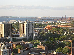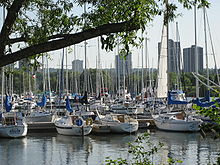
Hamilton is located on the western end of the Niagara Peninsula and wraps around the westernmost part of the Lake Ontario. Most of the city including the downtown section lies along the south shore. Situated in the geographic centre of the Golden Horseshoe, it lies roughly midway between Toronto and Buffalo. The two major physical features are Hamilton Harbour marking the northern limit of the city and the Niagara Escarpment running through the middle of the city across its entire breadth, bisecting the city into 'upper' and 'lower' parts.[1]
According to records from local historians, this district was called "Attawandaronia" by the native Neutral people.[2] Hamilton is one of 11 cities showcased in the book, "Green City: People, Nature & Urban Places" by Quebec author Mary Soderstrom, which examines the city as an example of an industrial powerhouse co-existing with nature.[3] Soderstrom credits Thomas McQuesten and family in the 1930s who "became champions of parks, greenspace and roads" in Hamilton.[4]
Hamilton Harbour is a natural harbour with a large sandbar called the Beachstrip. This sandbar was deposited during a period of higher lake levels during the last ice age, and extends southeast through the central lower city to the escarpment. Hamilton's deep sea port is accessed by ship canal through the Beachstrip into the harbour, the canal being traversed by two bridges, the QEW's Burlington Bay James N. Allan Skyway and the lower Canal Lift Bridge.[5]
Between 1788 and 1793, the townships at the Head-of-the-Lake were surveyed and named. The area was first known as The Head-of-the-Lake for its location at the western end of Lake Ontario. John Ryckman, born in Barton township (where present day downtown Hamilton is), described the area in 1803 as he remembered it: "The city in 1803 was all forest. The shores of the bay were difficult to reach or see because they were hidden by a thick, almost impenetrable mass of trees and undergrowth...Bears ate pigs, so settlers warred on bears. Wolves gobbled sheep and geese, so they hunted and trapped wolves. They also held organized raids on rattlesnakes on the mountainside. There was plenty of game. Many a time have I seen a deer jump the fence into my back yard, and there were millions of pigeons which we clubbed as they flew low."[6]


George Hamilton, a settler and local politician, established a town site in the northern portion of Barton Township in 1815. He kept several east–west roads which were originally Indian trails, but the north–south streets were on a regular grid pattern. Streets were designated "East" or "West" if they crossed James Street or Highway 6. Streets were designated "North" or "South" if they crossed King Street or Highway 8.[7] The overall design of the townsite, likely conceived in 1816, was commonplace. George Hamilton employed a grid street pattern used in most towns in Upper Canada and throughout the American frontier. The eighty original lots had frontages of fifty feet; each lot faced a broad street and backed onto a twelve-foot lane. It took at least a decade for all of the original lots to be sold, but the construction of the Burlington Canal in 1823, and a new court-house in 1827 encouraged Hamilton to add more blocks around 1828–9. At this time, he included a market square in an effort to draw commercial activity onto his lands, but the natural growth of the town was to the north of Hamilton's plot.[8]
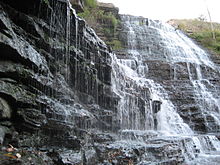
The Hamilton Conservation Authority owns, leases or manages about 4,500 hectares (11,100 acres) of land with the City operating 1,077 hectares (2,661 acres) of parkland at 310 locations.[9][10] Many of the parks are located along the Niagara Escarpment, which runs from Tobermory at the tip of the Bruce Peninsula in the north, to Queenston at the Niagara River in the south, and provides views of the cities and towns at the western end of Lake Ontario. The hiking path Bruce Trail runs the length of the escarpment.[11] Hamilton is home to more than 100 waterfalls and cascades, most of which are on or near the Bruce Trail as it winds through the Niagara Escarpment.[12]
- ^ Seward, Carrie. "About Hamilton; Physical features". Archived from the original on 2007-10-15. Retrieved 2008-01-25.
- ^ Watson, Milton (1938). Saga of a City. The Hamilton Spectator.
- ^ Soderstrom, Mary (2006). Green City: People, Nature & Urban Places. Independent Pub Group. ISBN 1-55065-207-9.
- ^ Lawson, B. (2007-01-26). "Green City". The Hamilton Spectator. p. Go-7.
- ^ "Burlington Bay/ Beach strip, Hamilton harbour, Skyway Bridge". Retrieved 2008-01-04. (Requires navigation to relevant articles.)
- ^ "A History of the city of Hamilton". Retrieved 2008-01-04.
- ^ Bailey, Thomas Melville (1981). Dictionary of Hamilton Biography (Vol I, 1791-1875). W.L. Griffin Ltd.
- ^ Weaver, John C. "Dictionary of Canadian Biography: George Hamilton". University of Toronto. Retrieved 2008-01-04.
- ^ Hamilton Conservation Authority. "HCH History: A Long History..." Archived from the original on 2007-06-07. Retrieved 2007-06-21.
- ^ City of Hamilton. "Hamilton Conservation Authority: City Parks". myhamilton.ca. Archived from the original on 2007-09-26. Retrieved 2008-01-04.
- ^ "Bruce Trail Association". Retrieved 2008-01-04.
- ^ Hamilton Conservation Authority Archived 2008-06-15 at the Wayback Machine
