Back ঘোড়াঘাট উপজেলা Bengali/Bangla ঘোড়াঘাট উপজিলা BPY Ghoraghat (subdistrito sa Bangladesh) CEB غوراغات Persian Ghoraghat French घोड़ाघाट उपज़िला Hindi Ghoraghat Italian घोड़ाघाट उपजिला MAI घोडाघाट उपजिल्ला Nepali ᱜᱷᱚᱲᱟᱜᱷᱟᱴ ᱩᱯᱚᱡᱮᱞᱟ SAT
Ghoraghat
ঘোড়াঘাট | |
|---|---|
 | |
 | |
| Coordinates: 25°14.7′N 89°13′E / 25.2450°N 89.217°E | |
| Country | |
| Division | Rangpur |
| District | Dinajpur |
| Area | |
| • Total | 148.67 km2 (57.40 sq mi) |
| Population (2011) | |
| • Total | 117,740 |
| • Density | 790/km2 (2,100/sq mi) |
| Time zone | UTC+6 (BST) |
| Website | Official Map of Ghoraghat |
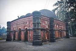
Ghoraghat (Bengali: ঘোড়াঘাট) is an upazila of Dinajpur District in the Division of Rangpur, Bangladesh.[1]
- ^ Shamsuzzaman (2012), "Ghoraghat Upazila", in Sirajul Islam and Ahmed A. Jamal (ed.), Banglapedia: National Encyclopedia of Bangladesh (Second ed.), Asiatic Society of Bangladesh