Back مقاطعة غرينزي (أوهايو) Arabic قورنزئی بؤلگهسی، اوهایو AZB Guernsey County, Ohio BAR Гърнзи (окръг, Охайо) Bulgarian গুরেনসি কাউন্টি, ওহাইও BPY Guernsey Gông (Ohio) CDO Guernsey County CEB Guernsey County, Ohio Welsh Guernsey County Danish Guernsey County German
Guernsey County | |
|---|---|
 | |
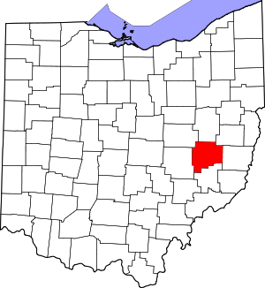
 Location within the U.S. state of Ohio | |
 Ohio's location within the U.S. | |
| Coordinates: 40°03′N 81°30′W / 40.05°N 81.5°W | |
| Country | |
| State | |
| Founded | January 31, 1810[1] |
| Named for | Isle of Guernsey |
| Seat | Cambridge |
| Largest city | Cambridge |
| Area | |
| • Total | 528 sq mi (1,370 km2) |
| • Land | 522 sq mi (1,350 km2) |
| • Water | 6.0 sq mi (16 km2) 1.1% |
| Population (2020) | |
| • Total | 38,438 |
| • Density | 73/sq mi (28/km2) |
| Time zone | UTC−5 (Eastern) |
| • Summer (DST) | UTC−4 (EDT) |
| Congressional district | 12th |
| Website | www |
Guernsey County is a county located in the U.S. state of Ohio. As of the 2020 census, the population was 38,438.[2] Its county seat and largest city is Cambridge.[3] It is named for the Isle of Guernsey in the English Channel, from which many of the county's early settlers emigrated.[4]
Guernsey County comprises the Cambridge, OH Micropolitan Statistical Area, which is also included in the Columbus-Marion-Zanesville, OH Combined Statistical Area.
- ^ "Ohio County Profiles: Guernsey County" (PDF). Ohio Department of Development. Archived from the original (PDF) on June 21, 2007. Retrieved April 28, 2007.
- ^ 2020 census
- ^ "Find a County". National Association of Counties. Retrieved June 7, 2011.
- ^ Gannett, Henry (1905). The Origin of Certain Place Names in the United States. Govt. Print. Off. pp. 145.

