| Hilltown South Australia | |||||||||||||||
|---|---|---|---|---|---|---|---|---|---|---|---|---|---|---|---|
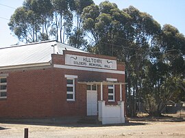
 Soldiers' Memorial Hall, Hilltown | |||||||||||||||
| Coordinates | 33°41′11″S 138°38′11″E / 33.6865°S 138.6364°E | ||||||||||||||
| Population | 42 (SAL 2021)[1] | ||||||||||||||
| Established | 1866 | ||||||||||||||
| Postcode(s) | 5455 | ||||||||||||||
| Elevation | 348 m (1,142 ft) | ||||||||||||||
| LGA(s) | Clare and Gilbert Valley Council | ||||||||||||||
| State electorate(s) | Frome | ||||||||||||||
| Federal division(s) | Grey | ||||||||||||||
| |||||||||||||||
Hilltown is a locality in the District Council of Clare and Gilbert Valleys of South Australia. The former town centre is located on Hilltown Road, which runs north-south between Andrews and Hill River, while the unsealed Harvey Highway connects the former town centre to RM Williams Way.[2] It is about 4 km east of RM Williams Way, on the former Spalding railway line.
- ^ Australian Bureau of Statistics (28 June 2022). "Hilltown (suburb and locality)". Australian Census 2021 QuickStats. Retrieved 28 June 2022.
- ^ "Hilltown, 5455". Location SA Map Viewer. Government of South Australia. Retrieved 16 February 2016.

