Back Hinchinbrook Island (pulo sa Ostralya) CEB Hinchinbrook Island German Parque Nacional Isla Hinchinbrook Spanish Île Hinchinbrook (Queensland) French Hinchinbrook Island (Queensland) Italian Hinchinbrook-eiland (Australië) Dutch Hinchinbrookøya NN Хинчинбрук (остров, Австралия) Russian Hinchinbrook Island Swedish جزیرہ ہنچن بروک Urdu
Native name: Pouandai | |
|---|---|
 Hinchinbrook Island looking west (i-cubed Landsat 7). | |
| Geography | |
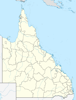
| Location | Coral Sea |
| Coordinates | 18°21′43″S 146°14′10″E / 18.362°S 146.236°E |
| Area | 393 km2 (152 sq mi)[1] |
| Length | 52 km (32.3 mi) |
| Width | 10 km (6 mi) |
| Highest elevation | 1,121 m (3678 ft) |
| Highest point | Mount Bowen |
| Administration | |
Australia | |
| State | Queensland |
| LGA | Cassowary Coast Region |
Hinchinbrook Island (or Pouandai to the Biyaygiri people)[2] is an island in the Cassowary Coast Region, Queensland, Australia.[3] It lies east of Cardwell and north of Lucinda, separated from the north-eastern coast of Queensland by the narrow Hinchinbrook Channel. Hinchinbrook Island is part of the Great Barrier Reef Marine Park and wholly protected within the Hinchinbrook Island National Park, except for a small and abandoned resort. It is the largest island on the Great Barrier Reef.[4] It is also the largest island national park in Australia.[5][6]
- ^ Ellison, J., 2000. Wetlands, Biodiversity and the Ramsar Convention, Chapt. 5; Ed. Hails, A.J. Case Study 1: Australia, Mangroves on Hinchinbrook Island. Australian Institute of Marine Science. Townsville, QLD. Australia.
- ^ Poignant, Roslyn (2004). Professional Savages, Captive Lives and Western Spectacle. New Haven: Yale. p. 22.
- ^ "Hinchinbrook Island – island in the Cassowary Coast Region (entry 15917)". Queensland Place Names. Queensland Government. Retrieved 3 August 2021.
- ^ "Hinchinbrook Island". The Sydney Morning Herald. 8 February 2004. Retrieved 6 May 2011.
- ^ "Hinchinbrook Island". queenslandholidays.com.au. Tourism Queensland. Retrieved 6 May 2011.
- ^ Hema maps. (1997). Discover Australia's National Parks. pp 178 – 179 Random House. ISBN 1-875992-47-2
