Back ایکوم AZB Ikom (distrito) CEB Ikom German Ikom Spanish ایکوم Persian Ikom French Ikom Hausa Ikom Italian Ikom Malagasy Ikom Polish
Ikom | |
|---|---|
LGA and town | |
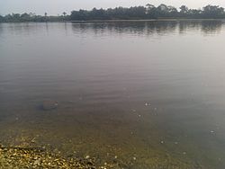
 The Cross River | |
| Coordinates: 6°05′N 8°37′E / 6.083°N 8.617°E | |
| Country | |
| State | Cross River State |
| Government | |
| • Local Government Chairman | Kingsley Egumi |
| Area | |
| • Total | 1,961 km2 (757 sq mi) |
| Population (2016 census) | |
| • Total | 79,103[1] |
| Time zone | UTC+1 (WAT) |
| 3-digit postal code prefix | 551 |
| ISO 3166 code | NG.CR.IK |
| Website | www |
 | |
Ikom is a Local Government Area of Cross River State in South-South, Nigeria.[2] Its headquarters are in the town of Ikom in the east of the area on the Cross River and the A4 highway at 5°57′40″N 8°42′39″E / 5.96111°N 8.71083°E.
It has an area of 1,961 km2 (757 sq mi) and had a population of 162,383 according to the 2006 census.[citation needed]
The people of Ikom are mostly farmers.[citation needed] Ikom is a major producer of cocoa, bananas and plantains for the Nigerian market.[citation needed]
Ikom is known for the Afi monoliths,[3] artifacts that bear an ancient[clarification needed][dubious – discuss] writing sometimes taken to be an early form of nsibidi.[4]
The postal code of the area is 551.[5]
Ikom Local Government is in the Central Senatorial District of Cross River State.
There are 11 (eleven) council wards:
- Abanyum
- Yala-Nkum
- Olulumo
- Ofutop I
- Ofutop II
- Nta/Nselle
- Nde
- Abijinkpor
- Ikom Urban
- Akparabong
- Nnam
The present geographical entity called Ikom local government area dates back to the 16th century during the pre-colonial era when the area extended to some communities now enclosed in Boki Obubra, Abi and Etung local government areas. Like other typical traditional societies, Ikom was governed by Chief priests or Village heads who were both ceremonial and religious.
Modern day Ikom began as a constituent part of the Afikpo Division in the early 1950s, when it was together with Afikpo now in Ebonyi State And in 1976, Ikom local government was created with headquarters at Ikom.
Ikom with a large size of 1,861.926 square kilometers is bounded on the North by Ogoja on the North-East by Boki, on the East by Etung Local Government and South by Obubra Local Government Area.
The major languages of the people include Ofutop Bakor, Yala, Mbembe and Ejagham. Ikom people are said to have originated from Bantu stock and their major occupation include farming trading and lumbering.
- ^ https://www.mindat.org/feature-2338242.html [bare URL]
- ^ "NigeriaGalleria - Enterprise, Awards, Innovation, Events, Brands, info - Celebrating Nigeria, telling our story". NigeriaGalleria - Enterprise, Awards, Innovation, Events, Brands, info. Retrieved 2021-09-11.
- ^ "African Rock Art". africanrockart.britishmuseum.org. Retrieved 2021-09-11.
- ^ "Ancient African Writing: Ancient Writing, Ancient Writing Systems, Ancient African Scripts".
- ^ "Post Offices- with map of LGA". NIPOST. Archived from the original on 2012-11-26. Retrieved 2009-10-25.
