Back İndre-Veydefiorden Milli Parkı Azerbaijani Taman Nasional Indre Wijdefjorden BAN Parc Nacional d'Indre Wijdefjorden Catalan Indre Wijdefjorden nationalpark Danish Indre-Wijdefjorden-Nationalpark German پارک ملی ایندر وایدهفیوردن Persian Indre Wijdefjordenin kansallispuisto Finnish Parc national d'Indre Wijdefjorden French Parco nazionale Indre Wijdefjorden Italian Nationaal park Indre Wijdefjorden Dutch
| Indre Wijdefjorden National Park | |
|---|---|
 | |
 | |
| Location | Spitsbergen, Svalbard, Norway |
| Nearest city | Longyearbyen |
| Coordinates | 79°N 16°E / 79°N 16°E |
| Area | 1,127 km2 (435 sq mi), of which 745 km2 (288 sq mi) is land 382 km2 (147 sq mi) is water |
| Established | 9 September 2005 |
| Governing body | Norwegian Directorate for Nature Management |
 | |
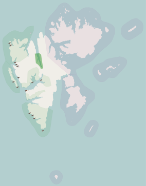
Indre Wijdefjorden National Park (Norwegian: Indre Wijdefjorden nasjonalpark) is located in a steep fjord landscape in northern Spitsbergen in Svalbard, Norway. It covers the inner part of Wijdefjorden—the longest fjord on Svalbard. The national park was established on 9 September 2005 and covers 1,127 km2 (435 sq mi), of which 745 km2 (288 sq mi) is on land and 382 km2 (147 sq mi) is sea. The marine environment changes vastly from the mouth of the fjord, through a still, cold, water basin, becoming deeper before reaching the glacier Mittag-Lefflerbreen at the inner-most sections of the fjord.
On both sides of Wijdefjorden there is High Arctic steppe vegetation, dominated by grasses and extremely dry, basic earth. There are some areas dominated by exposure of mineral earth. The area around the fjord has a vegetation which is unique and not preserved in other areas of Svalbard. Along with vegetation found on nesting cliffs, it is the most exclusive flora in Svalbard. There are several exclusive species in the national park, including Stepperøykvein, Puccinellia svalbardensis, Gentianella tenella and Kobresia simpliciuscula. Of the larger fjords on Svalbard, Wijdefjorden is the least affected by humans, although a trapping station has been built at Austfjordnes.