| Itcha Range | |
|---|---|
| Itcha Mountains Itchas | |
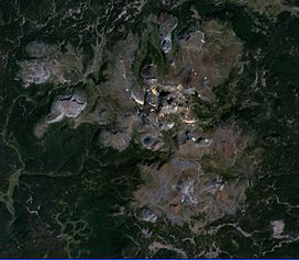
 Satellite image of the Itcha Range | |
| Highest point | |
| Peak | Mount Downton |
| Elevation | 2,375 m (7,792 ft) |
| Coordinates | 52°42′21″N 124°51′3″W / 52.70583°N 124.85083°W |
| Naming | |
| Native name | ʔAchax Dẑelh (Chilcotin) |
| Geography | |
| Country | Canada |
| Province | British Columbia |
| District | Range 3 Coast Land District |
| Range coordinates | 52°40′00″N 124°50′00″W / 52.66667°N 124.83333°W |
| Parent range | Chilcotin Plateau |
| Borders on | Ilgachuz Range |
| Topo map | NTS 93C10 Downton Creek |
| Geology | |
| Formed by | Shield volcano |
| Orogeny | Anahim hotspot |
| Age of rock | Neogene-to-Quaternary |
| Type of rock | Igneous |
The Itcha Range, also known as the Itchas, is a small isolated mountain range in the West-Central Interior of British Columbia, Canada. It is located 40 km (25 mi) northeast of the community of Anahim Lake. With a maximum elevation of 2,375 m (7,792 ft), it is the lowest of three mountain ranges on the Chilcotin Plateau extending east from the Coast Mountains. Two mountains are named in the Itcha Range; Mount Downton and Itcha Mountain. A large provincial park surrounds the Itcha Range and other features in its vicinity. More than 15 animal species are known to exist in the Itcha Range area, as well as a grassland community that is limited only to this location of British Columbia. The Itcha Range is within territory which has been occupied by aboriginal peoples for millennia. This area has a relatively dry environment compared to the Coast Mountains in the west.
In contrast to most mountain ranges in British Columbia, the Itcha Range represents an inactive shield volcano. This highly dissected volcanic edifice consists of a variety of rock types, including basanite, hawaiite, trachyte, rhyolite, phonolite and alkali olivine basalt. They were deposited by different types of volcanic eruptions characterized by passive lava flows and explosivity. Two stages of eruptive activity have been identified at the volcano along with three sub-phases that are limited only to the first stage of development. The main body of the Itcha Range is between 3.8 and 3.0 million years old and thus over two million years ago it passed the most active shield stage of life. A period of dormancy lasting for almost a million years followed, which was interrupted by the post-shield stage of volcanism 2.2 to 0.8 million years ago. More recent volcanic activity in and around the Itcha Range might have occurred in the last 340,000 years to produce cinder cones.
The Itcha Range is part of an east–west trending volcanic zone called the Anahim Volcanic Belt. This consists of large shield volcanoes, small cinder cones, lava domes and lava flows that become progressively younger from west to east. Several explanations have been made regarding the creation of this feature, each citing a different geologic process. If volcanic activity were to resume at the Itcha Range, Canada's Interagency Volcanic Event Notification Plan (IVENP) is prepared to notify people threatened by eruptions.

