Back Иваница Bulgarian Ivanjica BS Иваньица CE Ivanjica Czech Ivanjica German Ivanjica Spanish ایوانئیتسا Persian Ivanjica French Ivanjica Croatian Ivanjica Italian
Ivanjica
Ивањица (Serbian) | |
|---|---|
Town and municipality | |
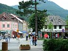
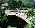
Clockwise, from top: Town panorama, "Stone Bridge", town center promenade | |
| Etymology: Saint John's Eve (Serbian: Ивањдан) | |
| Coordinates: 43°34′52″N 20°13′47″E / 43.58111°N 20.22972°E | |
| Country | |
| Region | Šumadija and Western Serbia |
| District | Moravica |
| Settlements | 49 |
| Village status | 1833 |
| Town status | 16 June 1866 |
| Government | |
| • Mayor | Momčilo Mitrović (SNS) |
| Area | |
| • Rank | 8th in Serbia |
| • Town | 3.68 km2 (1.42 sq mi) |
| • Municipality | 1,089.70 km2 (420.74 sq mi) |
| Elevation | 468 m (1,535 ft) |
| Highest elevation (Jankov Kamen peak) | 1,833 m (6,014 ft) |
| Population (2022)[2] | |
| • Rank | 50th in Serbia |
| • Municipality | 27,767 |
| • Municipality density | 25/km2 (66/sq mi) |
| Time zone | UTC+1 (CET) |
| • Summer (DST) | UTC+2 (CEST) |
| Postal code | 32250 32251 32252 32253 32254 32255 32256 32258 32259 |
| Area code | +381(0)32 |
| Vehicle registration | IC |
| Website | www |
Ivanjica (Serbian Cyrillic: Ивањица, pronounced [ǐʋaɲitsa]) is a town and municipality located in the Moravica District of southwestern Serbia. As of 2022 census, the municipality has a population of 27,767 inhabitants.[2] With an area of 1090 km2, it is the eighth largest municipality in Serbia.
Situated in the valley of Moravica river, Ivanjica has a predominantly hilly and mountainous terrain. It is surrounded by the mountain ranges of Golija, Javor, Mučanj, Čemerno and Radočelo. Ivanjica is known for cultural event Nušićijada which is taking place in the town annually.
- ^ "Насеља општине Ивањица" (PDF). stat.gov.rs (in Serbian). Statistical Office of Serbia. Archived from the original (PDF) on 14 November 2015. Retrieved 12 October 2019.
- ^ a b "Prvi rezultati Popisa stanovništva, domaćinstava i stanova 2022". stat.gov.rs (in Serbian). 21 December 2022. Retrieved 16 February 2023.
d


