Back إيفور (فيرجينيا) Arabic ايفور ARZ Ivor (Virgínia) Catalan Айвор (Виргини) CE Ivor CEB Ivor, Virginia Welsh Ivor (Virginia) Spanish Ivor (Virginia) Basque Ivor (Virginie) French Ivor, Vijini HT
Parts of this article (those related to demographics) need to be updated. (May 2017) |
Ivor, Virginia | |
|---|---|
 Buildings along General Mahone Blvd. in Ivor | |
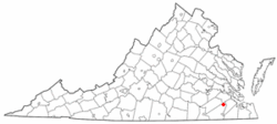
 Location of Ivor, Virginia | |
| Coordinates: 36°54′24″N 76°53′52″W / 36.90667°N 76.89778°W | |
| Country | United States |
| State | Virginia |
| County | Southampton |
| Area | |
| • Total | 1.09 sq mi (2.83 km2) |
| • Land | 1.09 sq mi (2.82 km2) |
| • Water | 0.00 sq mi (0.00 km2) |
| Elevation | 89 ft (27 m) |
| Population (2010) | |
| • Total | 339 |
| • Estimate (2019)[2] | 316 |
| • Density | 289.91/sq mi (111.97/km2) |
| Time zone | UTC−5 (Eastern (EST)) |
| • Summer (DST) | UTC−4 (EDT) |
| ZIP code | 23866 |
| Area code(s) | 757, 948 |
| FIPS code | 51-40232[3] |
| GNIS feature ID | 1495747[4] |
Ivor is an incorporated town in Southampton County, Virginia, United States. It is twenty-three miles northwest of Suffolk. The population was 320 at the 2000 census.
- ^ "2019 U.S. Gazetteer Files". United States Census Bureau. Retrieved August 7, 2020.
- ^ Cite error: The named reference
USCensusEst2019CenPopScriptOnlyDirtyFixDoNotUsewas invoked but never defined (see the help page). - ^ "U.S. Census website". United States Census Bureau. Retrieved January 31, 2008.
- ^ "US Board on Geographic Names". United States Geological Survey. October 25, 2007. Retrieved January 31, 2008.