| Jandakot Perth, Western Australia | |||||||||||||||
|---|---|---|---|---|---|---|---|---|---|---|---|---|---|---|---|
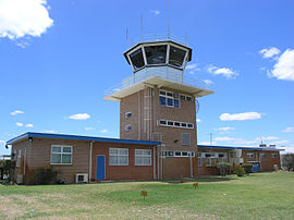
 Rear of air traffic control tower, 2006 | |||||||||||||||
 | |||||||||||||||
| Coordinates | 32°06′09″S 115°52′20″E / 32.1023906°S 115.8723359°E | ||||||||||||||
| Population | 2,533 (SAL 2021)[1] | ||||||||||||||
| Postcode(s) | 6164 | ||||||||||||||
| Area | 16.2 km2 (6.3 sq mi)[2] | ||||||||||||||
| Location | 21 km (13 mi) from Perth | ||||||||||||||
| LGA(s) | City of Cockburn | ||||||||||||||
| State electorate(s) | Jandakot | ||||||||||||||
| Federal division(s) | Fremantle | ||||||||||||||
| |||||||||||||||

Jandakot is a southern suburb of Perth, Western Australia, located within the City of Cockburn local government area. It is best known for Jandakot Airport that is situated entirely within the suburb, the airport being "the busiest general aviation airport in Australia in terms of aircraft movements",[3]: 2 the sixth-busiest civilian airport in Australia in the fiscal year ending 30 June 2018,[4] and in the 2011 fiscal year even the busiest civilian airport in Australia.[5]
- ^ Australian Bureau of Statistics (28 June 2022). "Jandakot (suburb and locality)". Australian Census 2021 QuickStats. Retrieved 28 June 2022.
- ^ Australian Bureau of Statistics (27 June 2017). "2016 Community Profiles: Jandakot (State Suburb)". 2016 Census of Population and Housing. Retrieved 3 December 2021.
- ^ "Jandakot Airport Master Plan 2014" (PDF). Jandakot Airport Holdings. 17 February 2015. Retrieved 16 March 2019.
- ^ "Movements at Australian Airports – 2018 Financial Year Totals" (PDF). Airservices Australia. 25 July 2018. Retrieved 16 March 2019.
- ^ "Movements at Australian Airports" (PDF). Airservices Australia. June 2011. Archived from the original (PDF) on 21 March 2016. Retrieved 12 July 2012.
