Back مقاطعة جيفرسون (فرجينيا الغربية) Arabic Jefferson County, West Virginia BAR Джеферсън (окръг, Западна Вирджиния) Bulgarian জেফারশন কাউন্টি, ৱেস্ট ভার্জিনিয়া BPY Jefferson Gông (West Virginia) CDO Джефферсон (гуо, Малхбузен Виргини) CE Jefferson County (kondado sa Tinipong Bansa, West Virginia) CEB Jefferson County, Gorllewin Virginia Welsh Jefferson County (West Virginia) German Κομητεία Τζέφερσον (Δυτική Βιρτζίνια) Greek
Jefferson County | |
|---|---|
 | |
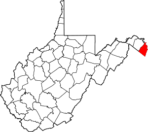
 Location within the U.S. state of West Virginia | |
 West Virginia's location within the U.S. | |
| Coordinates: 39°19′N 77°52′W / 39.31°N 77.86°W | |
| Country | |
| State | |
| Founded | October 26, 1801 |
| Named for | Thomas Jefferson |
| Seat | Charles Town |
| Largest city | Charles Town |
| Area | |
• Total | 212 sq mi (550 km2) |
| • Land | 210 sq mi (500 km2) |
| • Water | 2.0 sq mi (5 km2) 1.0% |
| Population (2020) | |
• Total | 57,701 |
• Estimate (2021) | 58,370 |
| • Density | 270/sq mi (110/km2) |
| Time zone | UTC−5 (Eastern) |
| • Summer (DST) | UTC−4 (EDT) |
| Congressional district | 2nd |
| Website | jeffersoncountywv.org |
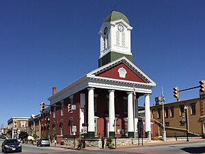
Jefferson County is located in the Shenandoah Valley in the Eastern Panhandle of West Virginia. It is the easternmost county of the U.S. state of West Virginia. As of the 2020 census, the population was 57,701.[1] Its county seat is Charles Town.[2] The county was founded in 1801, and today is part of the Washington metropolitan area.[3]
- ^ "State & County QuickFacts". United States Census Bureau. Retrieved March 25, 2022.
- ^ "Find a County". National Association of Counties. Archived from the original on May 31, 2011. Retrieved June 7, 2011.
- ^ "Jefferson County history sources". Archived from the original on May 30, 2013. Retrieved January 29, 2013.
