Back কমলপুর Bengali/Bangla কমলপুর BPY Kamalpur (lungsod) CEB Kamalpur Spanish कमलपुर, त्रिपुरा Hindi Kamalpur Italian कमलपुर NEW Kamalpur Dutch Kamalpur Portuguese Kamalpur Swedish
Kamalpur, India | |
|---|---|
Town | |
| Coordinates: 24°11′52″N 91°50′06″E / 24.19768°N 91.83487°E | |
| Country | |
| State | Tripura |
| District | Dhalai |
| Government | |
| • Type | Nagar Panchayat |
| • Body | Kamalpur Nagar Panchayat |
| • Chairman | Prasanta Sinha (BJP) |
| Elevation | 16 m (52 ft) |
| Population (2011) | |
| • Total | 10,904 |
| Demonym | Kamalpurbashi |
| Languages | |
| • Official | Bengali[1][2] |
| • Additional official | English[1] |
| Time zone | UTC+5:30 (IST) |
| Telephone code | +03826 |
| Vehicle registration | TR 04 |
| Lok Sabha constituency | Tripura East |
| Vidhan Sabha constituency | Kamalpur |
| Precipitation | 2,081 mm (82 in) |
| Avg. annual temperature | 24.5 °C (76 °F) |
| Website | tripura |
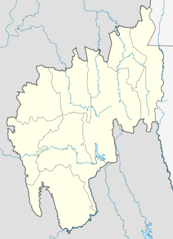
Kamalpur is a town and a Nagar Panchayat in Dhalai District in the Indian state of Tripura around 93 km from the state capital Agartala. It is the largest Sub-divisional town in Dhalai District.
- ^ a b "Fact and Figures". Wb.gov.in. Retrieved 10 March 2019.
- ^ "52nd Report of the Commissioner for Linguistic Minorities in India" (PDF). Nclm.nic.in. Ministry of Minority Affairs. p. 85. Archived from the original (PDF) on 25 May 2017. Retrieved 10 March 2019.

