Back نهر كنهان ARZ کانهان چایی AZB Kanhan Catalan Río Kanhan Spanish कन्हान नदी Hindi कन्हान नदी Marathi
| Kanhan River | |
|---|---|
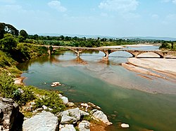
 Kanhan River near Ramkona. | |
 | |
| Location | |
| Country | India |
| State | Madhya Pradesh, Maharashtra |
| Region | Vidharba |
| District | Chhindwara District, Madhya Pradesh, Nagpur District, Maharashtra |
| Cities | Junnardeo, Damua, Sausar, Kamthi |
| Physical characteristics | |
| Source | Satpura Range |
| • location | Chhindwara District, Madhya Pradesh |
| • coordinates | 22°14′N 78°25′E / 22.233°N 78.417°E |
| Mouth | Wainganga River |
• location | Ambora, Nagpur district, Maharashtra |
• coordinates | 21°04′N 79°35′E / 21.067°N 79.583°E |
| Length | 275 km (171 mi) |
| Basin features | |
| Tributaries | |
| • left | Pench River, Sand River |
| • right | Bel River, Jam River, Kolar River, Nag River |
The Kanhan River is an important right bank tributary of the Wainganga River draining a large area lying south of Satpura range in central India. Along its 275 km run through the Indian States of Maharashtra and Madhya Pradesh, it receives its largest tributary - Pench River, a major water source for the metropolis of Nagpur.
Kanhan was not mentioned in the 2001 list of notified rivers in Maharashtra which has led to unrestricted exploitation in the form of sand mining along the river bed.[1] This failure to recognise its presence has been viewed as a deliberate attempt at unregulated economic gains. The catchment area has also seen large scale coal mining in recent years. Efforts are currently underway to notify the river to prevent further environmental damage. This has been undermined by plans[2] for construction of a barrage. The river was perennial until a few decades ago, but now goes dry by February every year.[3]