Back كياتس ARZ Keats Island (pulo sa Kanada, British Columbia) CEB Keats Island German Keats Island, British Columbia Swedish
Keats Island | |
|---|---|
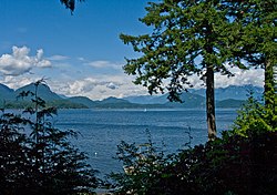
 Keats Island (centre) from the BC Ferry | |
 | |
| Coordinates: 49°24′N 123°27′W / 49.400°N 123.450°W | |
| Country | Canada |
| Province | British Columbia |
| Region | Howe Sound |
| Area | |
| • Total | 6 km2 (2.3 sq mi) |
| • Land | 6 km2 (2.3 sq mi) |
| Elevation | 242 m (795 ft) |
| Time zone | UTC−8 (PST) |
| • Summer (DST) | UTC−7 (PDT) |
| Area code(s) | 604, 778 |


Keats Island is an inhabited island located in Howe Sound near Vancouver, British Columbia. Most people who spend time on the island are visitors to one of the camps or the Marine Park, or owners of seasonal cottages.[1]
- ^ "Keats Island Official Community Plan". The Islands Trust. The Islands Trust. Retrieved 23 June 2024.