Back Kendari Afrikaans كنداري Arabic Kendari AST کئنداری AZB Kota Kendari BAN Кендары Byelorussian Kota Kendari BEW Kendari (kapital sa lalawigan sa Indonesya) CEB Kendari German Kendari Esperanto
Kendari | |
|---|---|
 Location within Southeast Sulawesi | |
| Coordinates: 3°59′27″S 122°30′31″E / 3.9907°S 122.5086°E | |
| Country | |
| Region | Sulawesi |
| Province | |
| Founded | 9 May 1831 |
| Incorporated | 1 July 1978 |
| City Status | 3 August 1995 |
| Government | |
| • Mayor | Muhammad Yusup (acting) |
| • Vice Mayor | Vacant |
| Area | |
| • Total | 270.14 km2 (104.30 sq mi) |
| Population ([1]) | |
| • Total | 351,085 |
| Time zone | UTC+8 (Indonesia Central Time) |
| Area code | (+62) 401 |
| HDI (2022) | |
| Website | kendarikota.go.id |
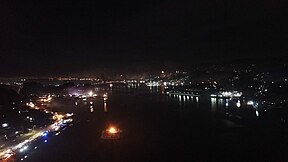
Kendari is the capital city of the Indonesian province of Southeast Sulawesi. It had a population of 289,966 at the 2010 Census[2] and 345,107 at the 2020 census,[3] making it the most populous city in the province, and the fourth most on Sulawesi. The official estimate as at mid 2023 was 351,085 - comprising 176,279 males and 174,806 females.[1] The city covers an area of 270.14 square kilometers (104.30 sq mi), or about 0.7 percent of Southeast Sulawesi's land area. Located on Kendari Bay, it continues to be an important trade center, with the province's main port and airport. It is the economic and educational center of the province, home to various universities and colleges. Kendari has the highest Human Development Index (HDI) in Sulawesi.[4]
- ^ a b Badan Pusat Statistik, Jakarta, 28 February 2024, Kota Kendari Dalam Angka 2024 (Katalog-BPS 1102001.7471)
- ^ Biro Pusat Statistik, Jakarta, 2011.
- ^ Badan Pusat Statistik, Jakarta, 2021.
- ^ "[Metode Baru] Indeks Pembangunan Manusia 2020-2021" [[New Method] Human Development Index 2020-2021] (in Indonesian). Statistics Indonesia. Retrieved 13 July 2022.


