Back کنت فیلد، کالیفورنیا AZB Кентфилд Bulgarian Kentfield Catalan Кентфилд (Калифорни) CE Kentfield CEB Kentfield German Kentfield Spanish Kentfield (Kalifornia) Basque کنت فیلد، کالیفرنیا Persian Kentfield French
Kentfield | |
|---|---|
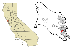
 Location in Marin County and the state of California | |
| Coordinates: 37°57′08″N 122°33′26″W / 37.95222°N 122.55722°W | |
| Country | |
| State | |
| County | Marin |
| Government | |
| • County Board | District 2 Katie Rice |
| • Senate | Mike McGuire (D) |
| • Assembly | Stephanie Nguyen (D) |
| • U. S. Congress | Jared Huffman (D)[1] |
| Area | |
| • Total | 3.046 sq mi (7.89 km2) |
| • Land | 3.027 sq mi (7.84 km2) |
| • Water | 0.019 sq mi (0.05 km2) 0.62% |
| Elevation | 115 ft (35 m) |
| Population (2020)[4] | |
| • Total | 6,808 |
| • Density | 2,249.1/sq mi (868.4/km2) |
| Time zone | UTC−8 (PST) |
| • Summer (DST) | UTC−7 (PDT) |
| ZIP codes | 94904, 94914 (PO boxes) |
| Area codes | 415/628 |
| FIPS code | 06-38114 |
| GNIS feature ID | 1658892 |
Kentfield (formerly Ross Landing, Tamalpais, and Kent)[5] is a census-designated place (CDP) in Marin County, California, United States, just north of San Francisco. Kentfield is located 2 miles (3 km) southwest of downtown San Rafael,[5] at an elevation of 115 feet (35 m).[3] The population was 6,808 at the 2020 census.[4] The ZIP codes are 94904 for street addresses, and 94914 for PO boxes, and are shared with the neighboring community of Greenbrae.
- ^ "California's 2nd Congressional District - Representatives & District Map". Civic Impulse, LLC. Retrieved March 8, 2013.
- ^ "2021 U.S. Gazetteer Files: California". United States Census Bureau. Retrieved July 6, 2022.
- ^ a b U.S. Geological Survey Geographic Names Information System: Kentfield, California
- ^ a b "P1. Race – Kentfield CDP, California: 2020 DEC Redistricting Data (PL 94-171)". U.S. Census Bureau. Retrieved July 6, 2022.
- ^ a b Durham, David L. (1998). California's Geographic Names: A Gazetteer of Historic and Modern Names of the State. Clovis, Calif.: Word Dancer Press. p. 648. ISBN 1-884995-14-4.
