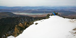
| Khangai Mountains alpine meadows | |
|---|---|
 View from Otgontenger | |
 Ecoregion territory (in yellow) | |
| Ecology | |
| Realm | Palearctic |
| Biome | Deserts and xeric shrublands |
| Geography | |
| Area | 23,014 km2 (8,886 sq mi) |
| Countries | Mongolia |
| Coordinates | 47°45′N 98°45′E / 47.750°N 98.750°E |
The Khangai Mountains alpine meadows ecoregion (WWF ID: PA1007) runs along the central ridge of the Khangai Mountains in central Mongolia. The slopes to the north are conifer forests, the lowlands to the south are semi-arid steppe. The Khangai are an "island" mountain range surrounded by lower forest steppe and semi-arid regions of central Mongolia. Most of the region is now protected by Tarvagatai Nuruu National Park and Khangai Nuruu National Park.[1][2]
- ^ "Central Asia: Central Mongolia". World Wildlife Federation. Retrieved March 21, 2020.
- ^ "Map of Ecoregions 2017". Resolve, using WWF data. Retrieved September 14, 2019.
