Back খগয়ানি জেলা (নঙ্গারহার) Bengali/Bangla Khūgyāṉī CEB ولسوالی خوگیانی Persian Distretto di Khogyani (Nangarhar) Italian Daerah Khogyani Malay Khogyani Dutch ضلع خوگیانی PNB خوگياڼي ولسوالۍ Pashto/Pushto Khugyani (Nangarhar) Swedish خوگیانی ضلع (ننگرہار) Urdu
Khogyani District | |
|---|---|
District | |
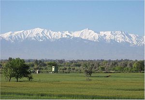
 Khogyani District, looking south | |
 Khogyani District is located in the south-west of Nangarhar Province. | |
| Country | |
| Province | Nangarhar Province |
| District center | Kaga |
| Time zone | UTC+4:30 (D† (Afghanistan Standard Time)) |
Khogyani (Pashto: خوږياڼي ولسوالۍ, Persian: ولسوالی خوگیانی) is a district in the south of Nangarhar Province, Afghanistan, bordering on Pakistan. Its population is entirely Pashtun, and was estimated at 146,852 in 2002. The district is within the heartland of the Khogyani tribe of Pashtuns.[1] The district centre is the village of Kaga (or Kazha). District Governor Office, District Court, District Hospital, and other government agencies hold their office in Kaga. Kaga is the economic center of the district; however Wazir is the second largest market place. Recently, Kaga town has been connected with Jalalabad City through paved road. Wazir is also connected through a paved road with Kaga.
Khogyani was one of the places in Afghanistan, where poppy cultivation got its highest point in Nangarhar Province.[citation needed] Although Khogyani is a district by itself, but it is divided by other several districts. Khogyani is famous for its pleasant weather, and high-quality fruits. Its apricots, walnuts, almonds and grapes are famous in Nangarhar province and throughout Afghanistan.[citation needed]
- ^ Nangarhar Province Tribal Map (Page 9). Naval Postgraduate School.