Back Kippens CEB Kippens French Kippens Dutch Kippens (Terra Nova e Labrador) Portuguese Kippens Swedish Кіппенс Ukrainian
Kippens | |
|---|---|
Town | |
 | |
 | |
| Coordinates: 48°32′57″N 58°37′25″W / 48.54917°N 58.62361°W | |
| Country | |
| Province | |
| Incorporated | 1968 |
| Area | |
| • Total | 14.32 km2 (5.53 sq mi) |
| Population (2021)[2] | |
| • Total | 1,842 |
| • Density | 140.3/km2 (363/sq mi) |
| Time zone | UTC-3:30 (Newfoundland Time) |
| • Summer (DST) | UTC-2:30 (Newfoundland Daylight) |
| Area code | 709 |
| Highways | |
| Website | Town of Kippens |
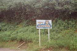
Kippens (Canada 2021 Census population 1,842)[2] is a town located in the province of Newfoundland and Labrador, Canada on the west coast of the island of Newfoundland.
The town of Kippens is situated on the West Coast of the province of Newfoundland. The town was granted its municipality status on December 31, 1968. Kippens borders the town of Stephenville to the east, the town of Port au Port East to the west, and St. George's Bay to the south. Extensive tracts of forests mark the northern boundary of the community, and Romaine's River (also known as Kippens River) runs in an east–west direction along the northern boundary of the community. The town exists mainly as a residential suburb of Stephenville with very little industrial or commercial activity taking place in the town.
- ^ Community Profiles: Kippens, Canada 2006 Census.
- ^ a b Cite error: The named reference
2021censuswas invoked but never defined (see the help page).