Back Коксейде Bulgarian Koksijde Breton Koksijde Catalan Koksijde (parokya) CEB Koksijde Danish Koksijde German Koksijde Esperanto Koksijde Spanish Koksijde Estonian Koksijde Basque
Koksijde
Koksyde (West Flemish) Coxyde (French) | |
|---|---|
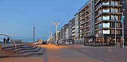
 Koksijde Zeedijk (Seadike) | |
| Coordinates: 51°06′N 02°39′E / 51.100°N 2.650°E | |
| Country | |
| Community | Flemish Community |
| Region | Flemish Region |
| Province | West Flanders |
| Arrondissement | Veurne |
| Government | |
| • Mayor | Marc Vanden Bussche (Open Vld) |
| • Governing party/ies | Liste du Bourgmestre, Vooruit |
| Area | |
| • Total | 50.36 km2 (19.44 sq mi) |
| Population (2018-01-01)[1] | |
| • Total | 21,957 |
| • Density | 440/km2 (1,100/sq mi) |
| Postal codes | 8670 |
| NIS code | 38014 |
| Area codes | 058 |
| Website | www.koksijde.be |
Koksijde (Dutch pronunciation: [ˈkɔksɛidə] ; French: Coxyde [kɔksid]; West Flemish: Koksyde) is a town and a municipality in Belgium. It is located on the North Sea coast in the southwest of the Flemish province of West Flanders.
The municipality comprises apart from Koksijde, the villages of Oostduinkerke, Saint-Idesbald and Wulpen.
On 1 January 2018, Koksijde municipality had a total population of 21,957 on a total area of 43.96 km2 (16.97 sq mi), which gives a population density of 499 inhabitants per square kilometre (1,290 inhabitants/sq mi).
Since 1995 Marc Vanden Bussche has been mayor of Koksijde.[2]
- ^ "Wettelijke Bevolking per gemeente op 1 januari 2018". Statbel. Retrieved 9 March 2019.
- ^ "Marc Vanden Bussche legt voor de vijfde keer eed af als burgemeester Koksijde". Krant van West-Vlaanderen (in Dutch). 3 January 2019. Retrieved 23 December 2021.


