Back Колубара Bulgarian Kolubara Catalan Kolubara Czech Kolubara (Fluss) German Κόλουμπαρα (ποταμός) Greek Río Kolubara Spanish رودخانه کلوبارا Persian Kolubara (rivière) French קולוברה HE Kolubara Croatian
| Kolubara | |
|---|---|
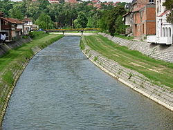
 Kolubara River in Valjevo | |
| Location | |
| Country | Serbia |
| Physical characteristics | |
| Source | |
| • location | Confluence of Obnica and Jablanica in Valjevo |
| Mouth | |
• location | into Sava River near Obrenovac |
• coordinates | 44°39′43″N 20°14′55″E / 44.6620°N 20.2485°E |
| Length | 86.6 km (53.8 mi) [1] |
| Basin size | 3,638 km2 (1,405 sq mi) [1] |
| Basin features | |
| Progression | Sava→ Danube→ Black Sea |
The Kolubara (Serbian Cyrillic: Колубара, pronounced [kɔlǔbara]) is a 87 km (54 mi) long river in western Serbia; it is an eastern, right tributary to the Sava river.
Due to the many long tributaries creating a branchy system within the river's drainage basin, the short Kolubara drains relatively large area of 3,639 km2 (1,405 sq mi). It is part of the larger Black Sea drainage.
The river is not navigable, but its valley is very important for transportation. Here are located Belgrade-Valjevo road, parts of Belgrade-Šabac road, Ibarska magistrala (Highway of Ibar) and the Belgrade-Bar railway.
The Kolubara was the site of one of the major battles on the Balkans in the World War I, the Battle of Kolubara in 1914.
There is a game hunting ground "Kolubara" in the valley of the river, on the territory of the Lazarevac municipality.[2]
- ^ a b "Sava River Basin Analysis Report" (PDF). International Sava River Basin Commission. September 2009. p. 14. Archived from the original (PDF, 9.98 MB) on 2010-07-17.
- ^ Branka Vasiljević (5 August 2018). "Lovci u Beograd stižu porodično" [Hunters travel to Belgrade with their families]. Politika (in Serbian).