| Kongorong South Australia | |||||||||||||||
|---|---|---|---|---|---|---|---|---|---|---|---|---|---|---|---|
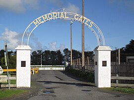
 Kongorong memorial gates | |||||||||||||||
| Coordinates | 37°54′00″S 140°33′18″E / 37.8999°S 140.5549°E[1] | ||||||||||||||
| Population | 221 (SAL 2021)[2] | ||||||||||||||
| Established | 30 March 1922 (town) 31 October 1996 (locality)[1][3][4] | ||||||||||||||
| Postcode(s) | 5291 | ||||||||||||||
| LGA(s) | District Council of Grant[5] | ||||||||||||||
| Region | Limestone Coast[6] | ||||||||||||||
| County | Grey[5] | ||||||||||||||
| State electorate(s) | Mount Gambier[7] | ||||||||||||||
| Federal division(s) | Barker[8] | ||||||||||||||
| |||||||||||||||
| |||||||||||||||
| Footnotes | Adjoining localities[5] | ||||||||||||||
Kongorong is a locality in the Australian state of South Australia located southwest of Mount Gambier.[5] It has an Australian rules football team and netball team. Kongorong Primary School had 61 students in 2010.[10]
- ^ a b "Search results for 'Kongorong, LOCB' with the following datasets being selected - 'Suburbs and Localities', 'Counties', 'Government towns', 'Local Government Areas', 'SA Government Regions' and 'Gazetteer'". Location SA Map Viewer. Government of South Australia. Retrieved 18 April 2018.
- ^ Australian Bureau of Statistics (28 June 2022). "Kongorong (suburb and locality)". Australian Census 2021 QuickStats. Retrieved 28 June 2022.
- ^ Bice, John G. (30 March 1922). "TOWN OF KONGORONG" (PDF). The South Australian Government Gazette. South Australian Government. p. 943. Retrieved 18 April 2018.
- ^ "GEOGRAPHICAL NAMES ACT 1991, Notice to Assign Boundaries and Names to Places" (PDF), The South Australian Government Gazette: 1517, 31 October 1996, retrieved 17 April 2018
- ^ a b c d "Placename Details: Kongorong". Property Location Browser. Government of South Australia. 4 March 2010. SA0015112. Archived from the original on 7 December 2015. Retrieved 23 January 2019.
- ^ "Limestone Coast SA Government region" (PDF). The Government of South Australia. Retrieved 10 October 2014.
- ^ "District of Mount Gambier Background Profile". Electoral Commission SA. Retrieved 28 March 2016.
- ^ "Federal electoral division of Barker" (PDF). Australian Electoral Commission. Retrieved 28 March 2016.
- ^ a b c "Monthly climate statistics: Summary statistics Mount Gambier Aero (nearest weather station)". Commonwealth of Australia, Bureau of Meteorology. Retrieved 21 August 2016.
- ^ "Kongorong Primary & CPC". Department for Education and Child Development. 19 October 2010. Retrieved 29 July 2015.

