Back Kuntillet 'Adschrud ALS Kuntillat Jurayyah CEB Kuntillet ʿAdschrud German کونتیلت عجرود Persian Kuntillet Ajrud French כונתילת עג'רוד HE Kuntillet Ajrud Italian Kuntillet Ajrud Polish Kuntillet Ajrud Portuguese Kuntillat Jurayyah Swedish
كونتيلة عجرود | |
 | |
| Alternative name | (חורבת תימן) |
|---|---|
| Region | Sinai |
| Coordinates | 30°11′10″N 34°25′41″E / 30.18611°N 34.42806°E |
| History | |
| Material | Stone |
| Periods | Iron Age |
| Cultures | Israelite |
| Site notes | |
| Excavation dates | 1975–76 |
| Archaeologists | Ze’ev Meshel |
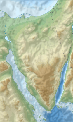
Kuntillet ʿAjrud (Arabic: كونتيلة عجرود) or Horvat Teman (Hebrew: חורבת תימן) is a late 9th/early 8th centuries BCE site in the northeast part of the Sinai Peninsula.[1] It is frequently described as a shrine, though this is not certain.[2] The Kuntillet Ajrud inscriptions discovered in the excavations are significant in biblical archaeology.

Kuntillet Ajrud is in the north Sinai; carbon-14 dating indicates occupation from 801–770 BCE, and the eponymous texts may have been written c. 800 BCE.[3] As a perennial water source in this arid region, it constituted an important station on an ancient trade route connecting the Gulf of Aqaba (an inlet of the Red Sea) and the Mediterranean. It was located only 50 kilometers from the major oasis of Kadesh Barnea.[4] Additionally, despite its proximity to the Kingdom of Judah, it has an association with the northern Kingdom of Israel (Samaria): "elements of the material culture such as the pottery, the 'northern' orthography in certain inscriptions, and reference to YHWH of Samaria suggest that Kuntillet ʿAjrud was an Israelite outpost, or at the very least, had a strong Israelite presence" .[5]
- ^ Gnuse 1997, p. 69–70.
- ^ Hadley 2000, p. 108.
- ^ Mastin 2005, p. 326.
- ^ Schniedewind 2017, p. 135.
- ^ Mandell, Alice (1 January 2012). ""I Bless You to YHWH and His Asherah"—Writing and Performativity at Kuntillet ʿAjrud". Maarav. 19 (1–2): 132. doi:10.1086/MAR201219108.
