Back لا باز (المكسيك) Arabic لا باز (تجمع سكان فى لا پاز مونيسيپاليتى) ARZ Ла Пас (Южна Долна Калифорния) Bulgarian La Paz (Mèxic) Catalan La Paz (kapital sa estado sa Mehiko, Estado de Baja California Sur, La Paz) CEB لا پاز، مەکسیک CKB La Paz (Baja California Sur) Czech La Paz (Baja California Sur) Danish La Paz (Baja California Sur) German Λα Πας (Μπάχα Καλιφόρνια Σουρ) Greek
La Paz | |
|---|---|
|
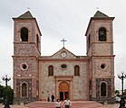
Top: La Paz coastline; middle: Old City Hall (left) and Balandra Beach (right); bottom: Perla de la Paz monument (left) and Our Lady of Peace Cathedral
(right). | |
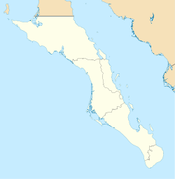
| Coordinates: 24°08′32″N 110°18′39″W / 24.14222°N 110.31083°W | |
| Country | Mexico |
| State | Baja California Sur |
| Municipality | La Paz |
| Founded | 3 May 1535[2] |
| named La Paz | 1596 |
| Government | |
| • Municipal president | Milena Paola Quiroga Romero (MORENA) |
| Elevation | 27 m (89 ft) |
| Population (2020) | |
| • Total | 250,141[1] |
| Data source: INEGI | |
| Time zone | UTC−07:00 (MST) |
| • Summer (DST) | UTC−06:00 (MDT) |
| Website | www |
| Source: Enciclopedia de los Municipios de México | |
La Paz (pronounced [la ˈpas] , English: Peace) is the capital city and the largest city of the Mexican state of Baja California Sur. The city had a 2020 census population of 250,141 inhabitants,[1] making it the most populous city in the state. It is in La Paz Municipality, which is the fourth-largest municipality in Mexico in geographical size and reported a population of 292,241 inhabitants on a land area of 20,275 km2 (7,828 sq mi).[3]
La Paz is served by the Manuel Márquez de León International Airport with flights to Mexico's three largest cities, cities across Northwest Mexico, and seasonal service to American Airlines hubs Dallas and Phoenix. Two ferry services operate from the port of Pichilingue outside the city, connecting the Baja California peninsula to the mainland at Mazatlán and Topolobampo, near Los Mochis.
- ^ a b "INEGI. Censo de Población y Vivienda 2020. Tabulados del Cuestionario Básico – Baja California Sur" [INEGI. 2020 Population and Housing Census. Basic Questionnaire Tabulations – Baja California Sur] (Excel) (in Spanish). INEGI. 2020. pp. 1–4. Archived from the original on 28 January 2021. Retrieved 28 January 2021.
- ^ "Historia". State of Baja California Sur. Archived from the original on 3 August 2014. Retrieved 13 August 2014.
- ^ (in Spanish) Los Municipios con Mayor y Menor Extensión Territorial Archived 3 March 2007 at the Wayback Machine, Instituto Nacional Para el Federalismo y el Desarrollo Municipal, SEGOB (Mexico.) Accessed 15 February 2008.


