Back La Pobla de Claramunt AN لا بوبلا دي كلارامونت Arabic La Pobla de Claramunt AST لا پبلا د کلارامونت AZB La Pobla de Claramunt Catalan Ла-Побла-де-Кларамун CE La Pobla de Claramunt (munisipyo) CEB La Pobla de Claramunt German La Pobla de Claramunt DIQ La Pobla de Claramunt Spanish
La Pobla de Claramunt | |
|---|---|
 Avinguda Catalunya | |
| Coordinates: 41°33′16″N 1°40′47″E / 41.55444°N 1.67972°E | |
| Country | |
| Community | |
| Province | Barcelona |
| Comarca | Anoia |
| Government | |
| • Mayor | Santiago Broch Miquel (2015)[1] |
| Area | |
| • Total | 18.5 km2 (7.1 sq mi) |
| Elevation | 246 m (807 ft) |
| Population (2018)[3] | |
| • Total | 2,177 |
| • Density | 120/km2 (300/sq mi) |
| Demonym(s) | Pobletà, pobletana |
| Website | www |
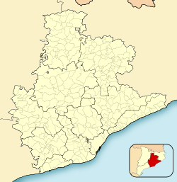
La Pobla de Claramunt (Catalan pronunciation: [lə ˈpob.blə ðə kləɾəˈmun]) is a municipality in the comarca of the Anoia in Catalonia, Spain. It is situated on the edge of the Òdena Basin at the entrance to the Capellades Gorge. The town is dominated by Claramunt castle, on a hilltop some 150 m above the modern settlement: the castle was, with Castellbell castle, one of the main points of control of access to the Llobregat valley and hence to Barcelona. With neighbouring Capellades, La Pobla de Claramunt is an important centre for paper manufacture. It is served by a station on the FGC railway line R6 from Barcelona and Martorell to Igualada and by the C-244 road from Igualada to Vilafranca del Penedès.
- ^ "Ajuntament de la Pobla de Claramunt". Generalitat of Catalonia. Retrieved 2015-11-13.
- ^ "El municipi en xifres: La Pobla de Claramunt". Statistical Institute of Catalonia. Retrieved 2015-11-23.
- ^ Municipal Register of Spain 2018. National Statistics Institute.


