Back بحيرة البرلس Arabic بحيرة البرلس ARZ Burul·lus Catalan Buḩayrat al Burullus CEB Burullus-See German Lago Burullus Spanish Burullus Finnish Lac Bourlos French Lago Burullus Italian ဘုရူလက်ကန် Burmese
| Lake Burullus | |
|---|---|
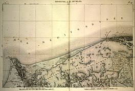
 Map of Lake Burullus from the early 19th century | |
| Coordinates | 31°29′N 30°52′E / 31.483°N 30.867°E |
| Max. length | c. 54 km (34 mi)[1] |
| Max. width | 6–21 km (3.7–13.0 mi)[1] |
| Surface area | 46,200 ha (114,000 acres) |
| Average depth | 75–100 cm (30–39 in)[1] |
| Designated | 9 September 1988 |
| Reference no. | 408[2] |
Lake Burullus (Arabic: بحيرة البرلس, romanized: Buḥayrat al-Burullus; Greek: λίμνη Σεβεννυτική, translit. limnē Sebennytikē)[3] is a brackish water lake in the Nile Delta in Egypt, the name coming from Burullus town (Coptic: Ϯⲡⲁⲣⲁⲗⲓⲁ,[4] from Ancient Greek παράλιος, "coast, seaside" or ⲛⲓⲕⲉϫⲱⲟⲩ Nikejow). It is located in Kafr el-Sheikh Governorate east of Rosetta, bordered by the Mediterranean Sea in the north and agricultural land to the south.
- ^ a b c Finkl, Charles W.; Makowski, Christopher (2017). Coastal Wetlands: Alteration and Remediation. Springer. p. 418. ISBN 9783319561790.
- ^ "Bahía de Samborombón". Ramsar Sites Information Service. Retrieved 25 April 2018.
- ^
 Smith, William, ed. (1857). "Sebennytus". Dictionary of Greek and Roman Geography. Vol. 2. London: John Murray. p. 946.
- ^ Pauline Todry. "21- أسماء بعض البلاد المصرية بالقبطية" [The names of some Egyptian countries in Coptic -21]. St-Takla.org (in Arabic).
